
Thursday Information
Recent model guidance over the past 24 hours has included many changes with this storm as a whole, as it is a large system. We are now expected the later end of the Thursday morning commute and holiday travel Thursday morning to be impacted by a period of moderate snow in much of Central Pennsylvania. Due to the cold weather the past few days and temperatures around 29-32 degree as the snow is falling, untreated roads will become slushy and snow-covered quickly.
Timing
Moderate snow will move into the ridges and valleys of South Central PA by 7-9am Thursday morning. A 1-2 hour period of freezing rain is possible in the Lower Susquehanna Valley (7-9am) and Lehigh Valley (9-11am). A longer period of freezing rain is expected over the Laurel Highlands of Somerset and Cambria County from 8am-4pm, which may result in .1 – .2″ of ice.
Snow will then change to rain from south to north from 12pm Thursday in Southern PA to 3pm in Northern PA. So this will not be a long period of snow, but snowfall rates of a half inch to one inch an hour are likely. Below is future radar from this morning’s High Resolution NAM model.
Road Impacts
Travel is not advised during the expected period of snow or freezing rain, as roadway temperatures will support immediate impacts as precipitation begins. Please avoid traveling during the timing outlined above.
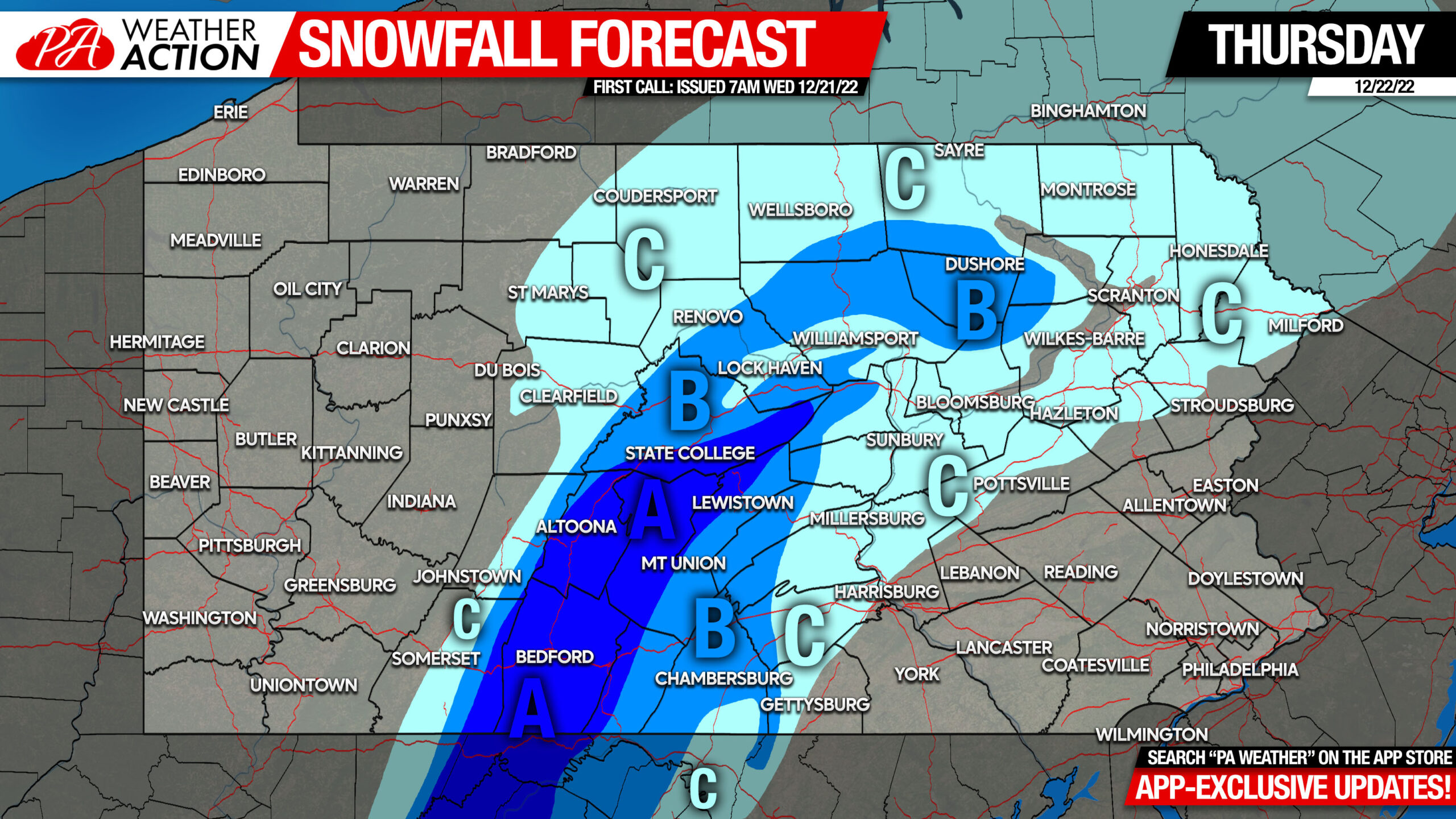
First Call Snowfall Forecast for Thursday Only
[fwdzoomer preset_name=”skin1″ image_name=”First Call Snowfall Dec 21″]
Note: Ice accumulations of 0.1 – 0.2″ are expected in Somerset and Cambria County.
Area A: Snow accumulations of 3 – 5″ are expected Thursday. Snow cover will last into the weekend, as temperatures are not expected to get above 35 degrees during the ensuing rainfall.
Area B: Snow accumulations of 2 – 3″ are expected Thursday. Snow cover will likely last into the weekend, as temperatures are not expected to get above 37 degrees during the ensuing rainfall.
Area C: Snow accumulations of 1 – 2″ are expected Thursday.
Want to be always in the loop on latest model trends and read human-written updates for upcoming snow? Head over to the Updates section of our app, where you’ll find updates twice daily and many more maps! There’s a free 1 week trial, so if you don’t like it, you can cancel. Tap the banner below!
Friday Information
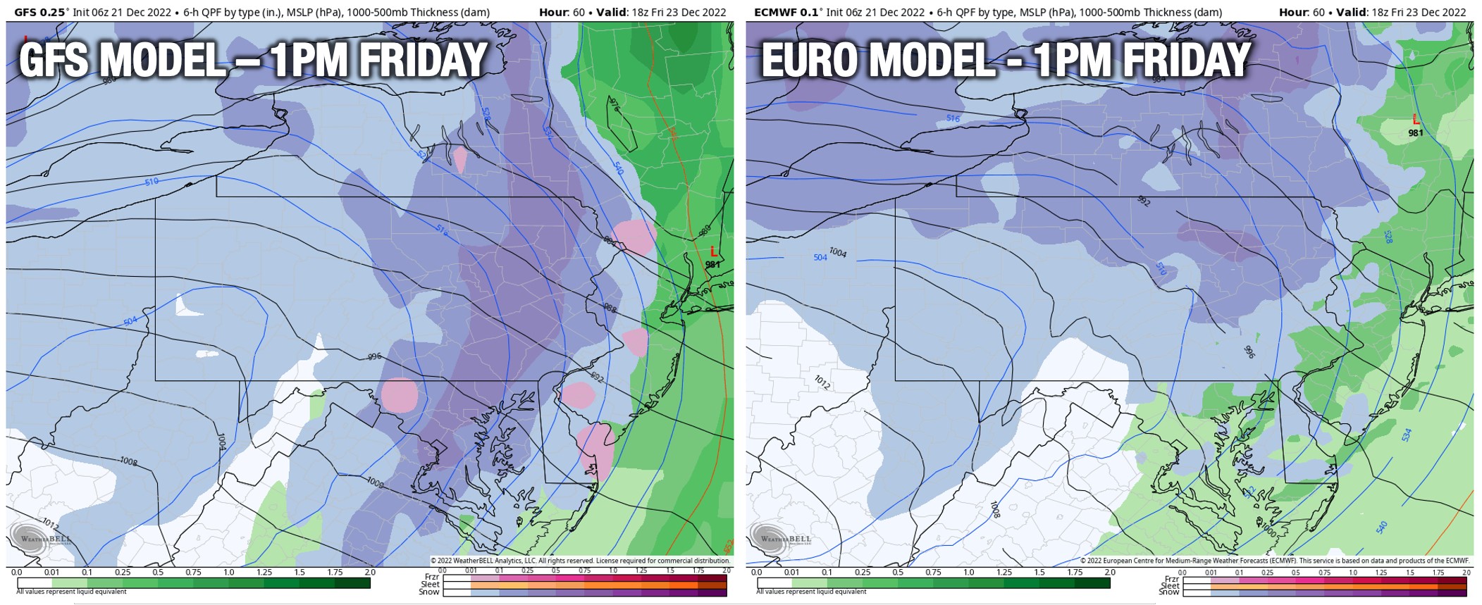
Short range models are beginning to come into play with this setup, there’s a lot of moving parts and even several different low pressure centers. In order for much of Central and Eastern PA to see a few inches of snow Friday, a strong secondary low pressure system will need to develop over Virginia and track right into Eastern PA, eventually joining the primary low pressure in Ontario.
Currently, two models are on board. The GFS remains very consistent with this idea, and the 3km NAM, which is now coming into range, is somewhat on board. It doesn’t quite bomb the low as deep as the GFS, but it produces a few inches of snow in most of the state Friday.
The Euro and Canadian models have a different, and similar upper level configuration that only produces snow in Western PA and north of I-80 in Central and Eastern PA Friday.
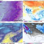
I was previously leaning towards the Euro model solution, but with the 3km NAM joining the GFS, it’s clear we need to give this situation more time. Below is a comparison of the GFS and the Euro at the same timestamp.
As far as a flash freeze, we have some good news. There will likely be a 3-4 hour period of dry and windy conditions before the Arctic front comes through, which should be enough time to dry out the roadways. There will still be icy patches where there was standing water, but there’s a good chance widespread black ice will be avoided.
Since the 3km (high resolution) NAM model is not quite as crazy as the GFS, and actually quite believable, here is what it looks like on Friday as the Arctic front and associated snow moves through. Any green shown behind the front will not be rain, it’ll be snow. That’s just a blemish with the program.
We may have a First Call Snowfall Forecast for Friday out this evening, but more than likely models will stay split and I’ll have to see more short range guidance so that call may not come until Thursday!
You must be logged in to post a comment.