
Summary
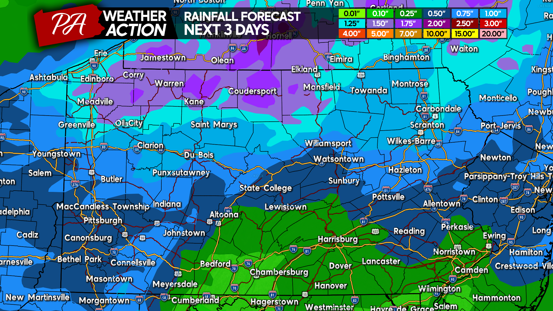
The Great Lakes upper level low will move east today through Upstate NY, bringing the northern half of Pennsylvania consistent showers and embedded thunderstorms. An isolated strong to severe thunderstorm is possible in parts of Eastern PA this afternoon – early evening. Then a clear Thursday before another low brings showers and thunderstorms to Western PA Thursday Night and Central & Eastern PA on Friday. Besides a stray shower in Eastern PA, this weekend will be dry and very nice.
Future Radar (Mid Wednesday AM – Early Friday PM)
Rainfall Forecast (Wed AM – Sat AM)
Check our map room for current conditions, current alerts, and precipitation forecast maps!
Wednesday Severe Thunderstorm Threat Forecast
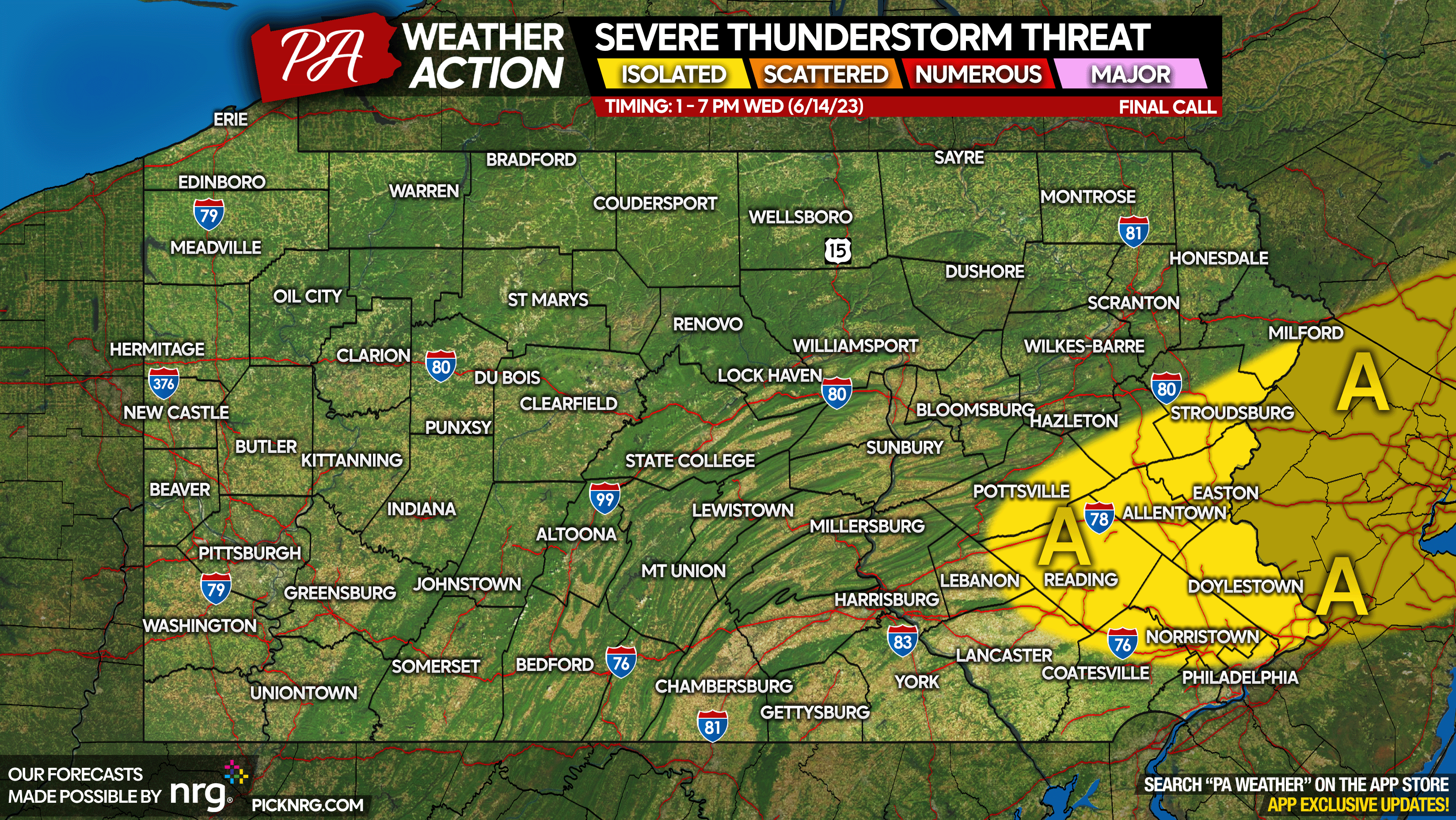
Area A: Scattered thunderstorms Wednesday afternoon – early evening, with an isolated severe thunderstorm possible. Minor risks include gusty winds up to 40-50mph (very isolated) and small hail.
Daily Forecast Graphics


Don’t see your town on the maps? No problem! Our app has forecasts and radar down to the mile, and of course all our articles and updates! Tap the banner below to get it on your phone’s app store!

Feel free to share this forecast using the buttons below!
[social_warfare]
You must be logged in to post a comment.