
Much of the state picked up a half inch of rain or more Monday, and more rainfall is coming to the commonwealth today and more so Wednesday.
Timing
Pockets of rain will push into Western PA late this afternoon, with widespread rain overtaking much of Western PA by late this evening. From there, an area of moderate rain will persist through around sunrise Wednesday in Western PA before pushing east and beginning during the Wednesday AM commute in Central PA.
That area of moderate rain will rotate northeast around the low pressure that’s over the Great Lakes, into Northeast PA by lunchtime Wednesday, while largely missing Southeast PA.
Isolated thunderstorms will develop early Wednesday afternoon across the entire state, before pushing east and weakening by sunset Wednesday.
Future Radar (3km NAM)
Rainfall Totals Forecast Map
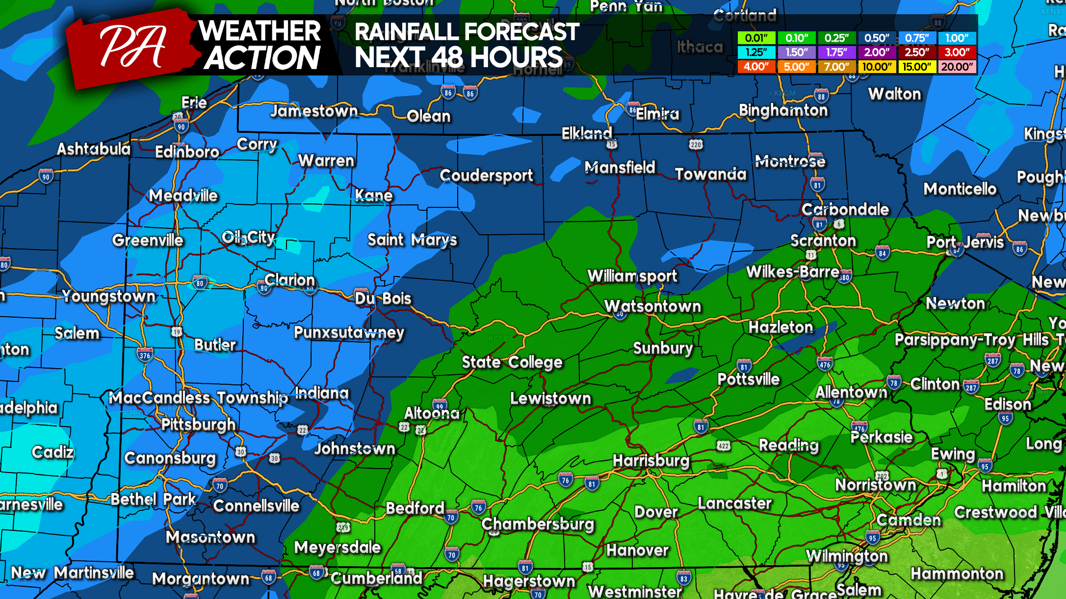
Rainfall totals between 0.50 – 1.00″ are expected in Western PA and near Route 6 in Northern PA. Isolated pockets greater than 1.00″ possible from Butler to Warren.
South and east, rainfall totals will be lesser as these locations are simply too far away from the upper level low and will miss the rain spinning around it. So generally 0.10 – 0.25″ in South Central & Southeast PA.
Severe Thunderstorm Threat Map
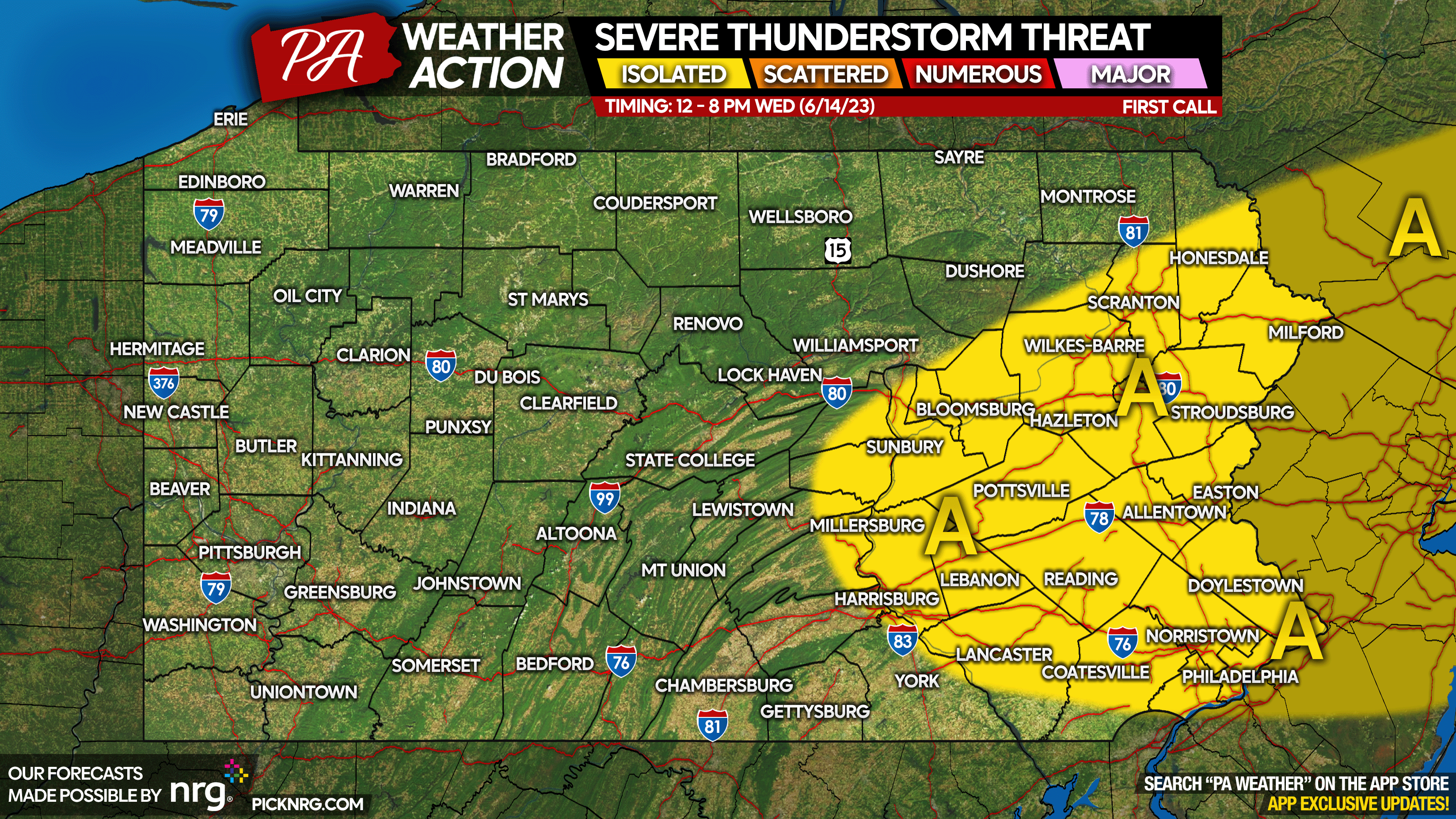
Area A: Isolated severe thunderstorms possible Wednesday afternoon into the early evening. However, most thunderstorms will be ordinary storms with a bit of lightning and wind. The primary threat in any stronger storms will be damaging winds.
Thanks for reading! If you found this article useful, consider sharing it with friends and family below!
[social_warfare]
Download our app for a forecast and radar that is down to the mile! Tap the banner below to get it free today!

You must be logged in to post a comment.