


What looked to be a near miss for Southeast PA a couple days ago, now looks like a moderate snowfall event, with significant to even major totals along the coast. Over the last 36-48 hours, there has been a consistent Northwest trend with how far the snow bands extend Northwest into PA. With that said, we have upgraded and pushed our zones farther Northwest into PA from our previous call last night.
Below is the latest RGEM valid 1 PM Tomorrow Afternoon, representing the shift Northwest well: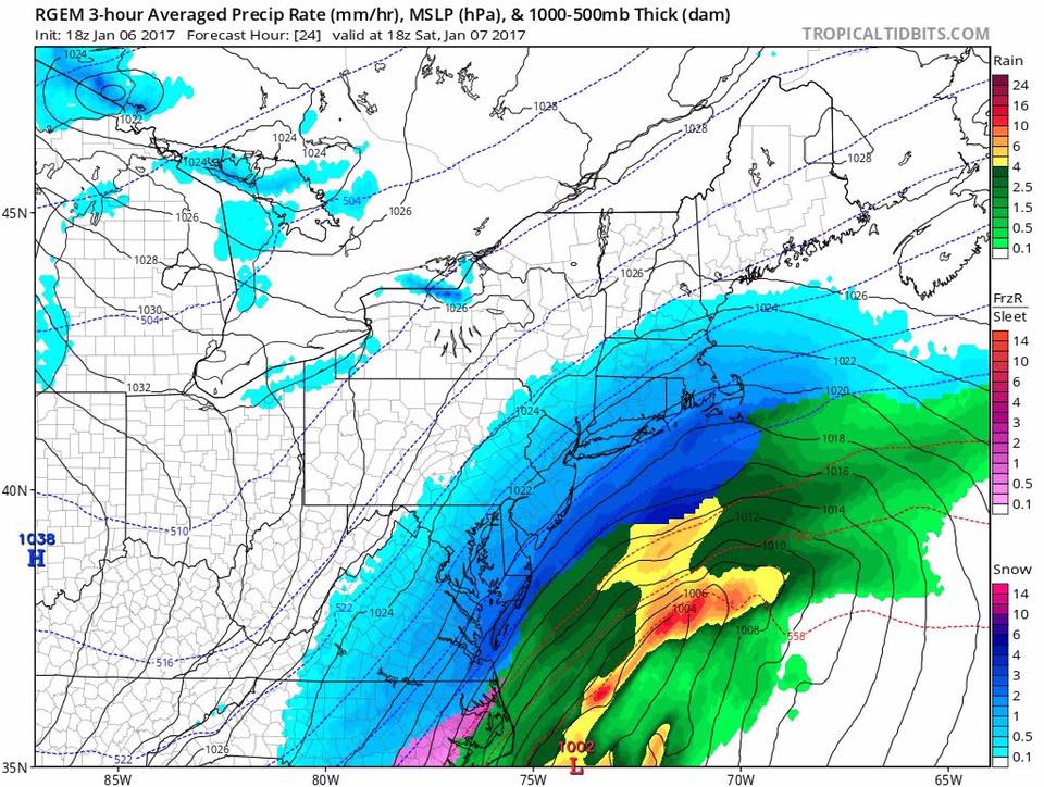
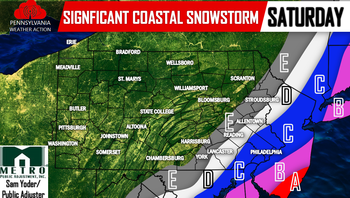
FINAL CALL SNOW TOTALS
Timing: The snow will begin between 5 am and 8 am South to North and will end between 4 PM and 7 PM.
This will be a major now-cast situation, have us liked on Facebook for updates throughout the day Tomorrow>>>PA Weather Action on Facebook!
Area A (Red): 7 to 10 inches of heavy snowfall is expected, travel not recommended.
Area B (Pink): 4 to 7 inches of heavy snowfall is expected, travel not recommended.
Area C (Blue): 2 to 4 inches of snowfall is expected, travel not recommended.
Area D (White): 1 to 2 inches of snowfall is expected, travel with caution.
Area E (Gray): Snow showers possible.
We will continue to monitor the latest short range guidance and also observations to see if we have to make any last minute adjustments.
Don’t forget to share with your family and friends below! Stay safe!
You must be logged in to post a comment.