Daily Forecast for Wednesday, September 19th, 2018
Early morning fog is possible in isolated locations, otherwise a mix of clouds and sunshine can be expected today with temperatures in the 70s and lower 80s. Have a great day!
A wet start to the work week is expected, with heaviest rain over Western PA. View yesterday’s article for expected rainfall totals. Highs will be in the upper 60s and 70s across the state.
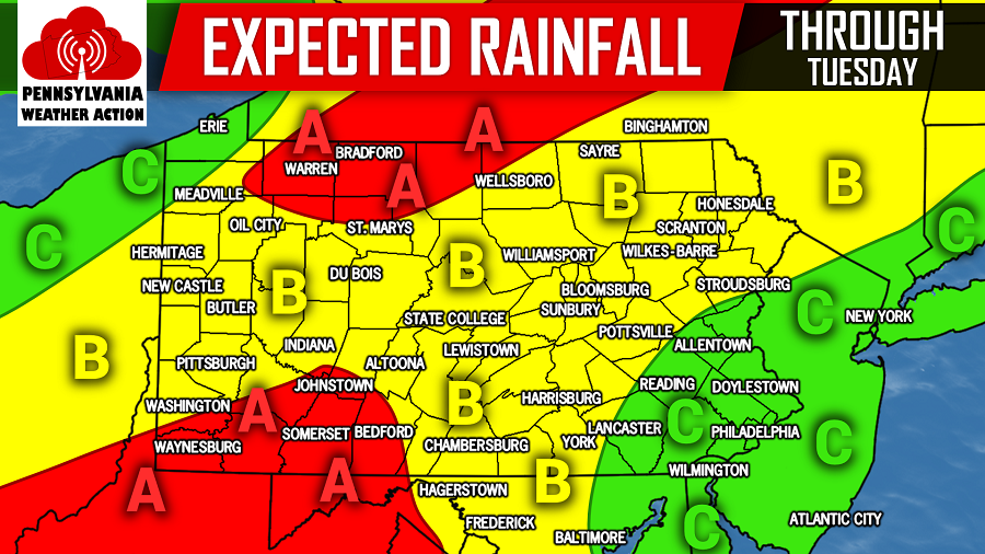
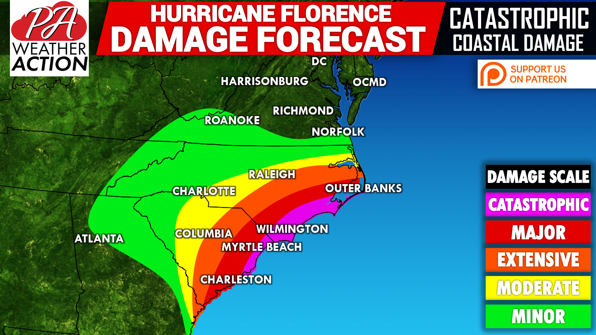
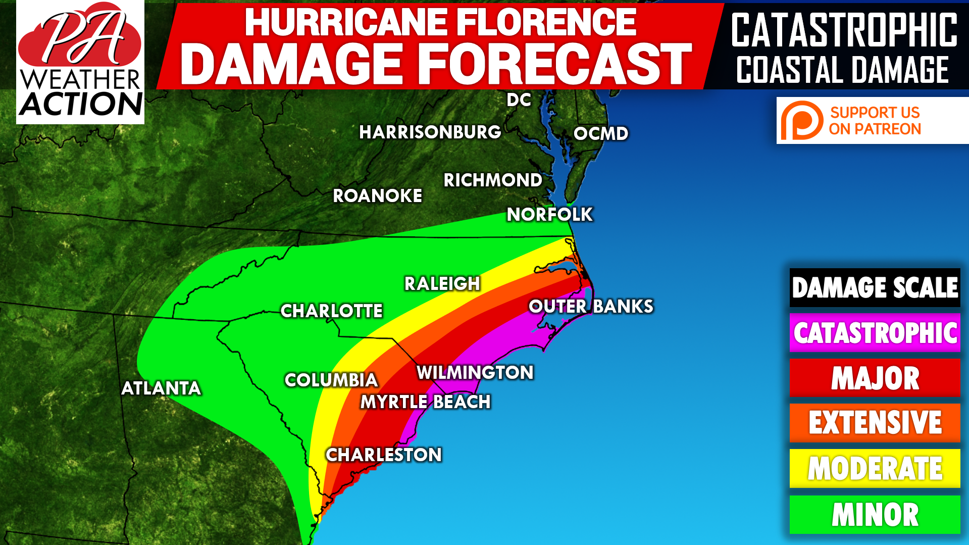
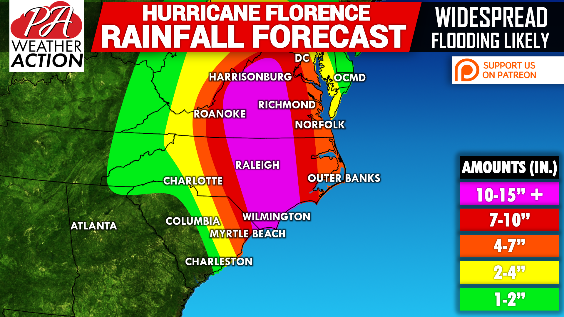
Hurricane Florence has brought historic amounts of rainfall to North Carolina over the last several days and close to record breaking rainfall amounts in surrounding areas. Now that Hurricane Florence remnants are officially pushing north, we can expect a rainy Monday as moderate to heavy rainfall is expected state-wide. The rainfall may linger into Tuesday,…
A mix of clouds and sun is expected today with temperatures in the 70s and low 80s. Enjoy the dry weather as Hurricane Florence remnants will overspread the area by the late morning hours tomorrow. Below is a look at the future radar valid for 12:00 PM Monday: We will have a rainfall map posted…
The weekend is here, and so is some semi-decent weather! We don’t expect much in the way of rain today, with partly to mostly cloudy skies overhead. Highs will be in the generally around 80. Below is your daily forecast in graphic form.
A mostly cloudy day is expected for your Friday with a few scattered showers possible. We will have more updates on Hurricane Florence throughout the day today so stay tuned to our Facebook page. Have a great day!
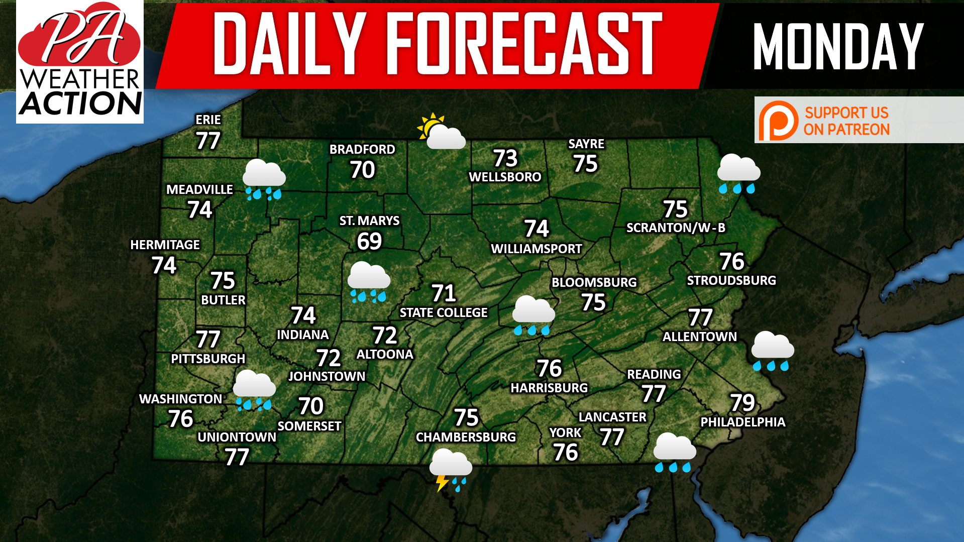
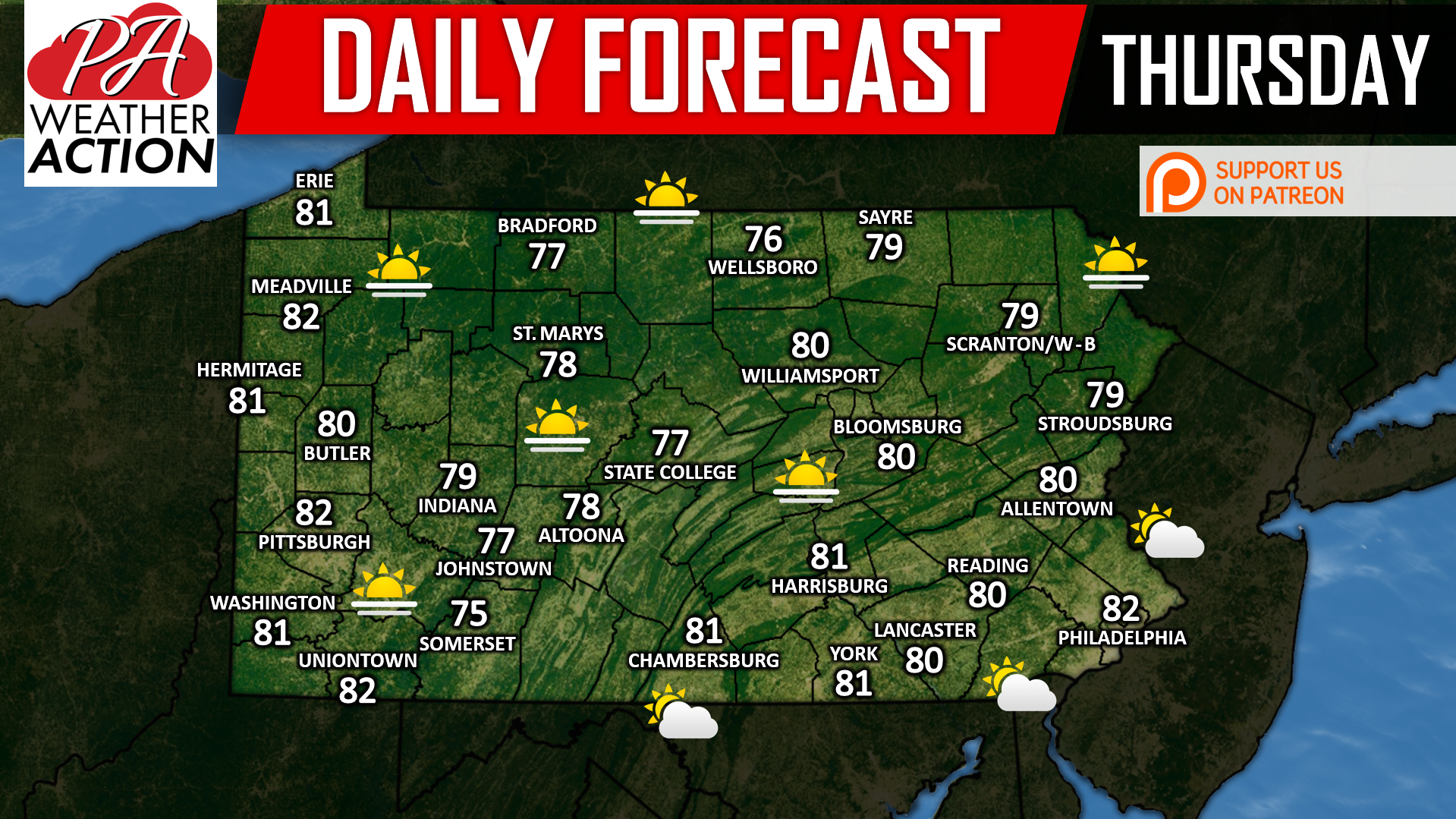
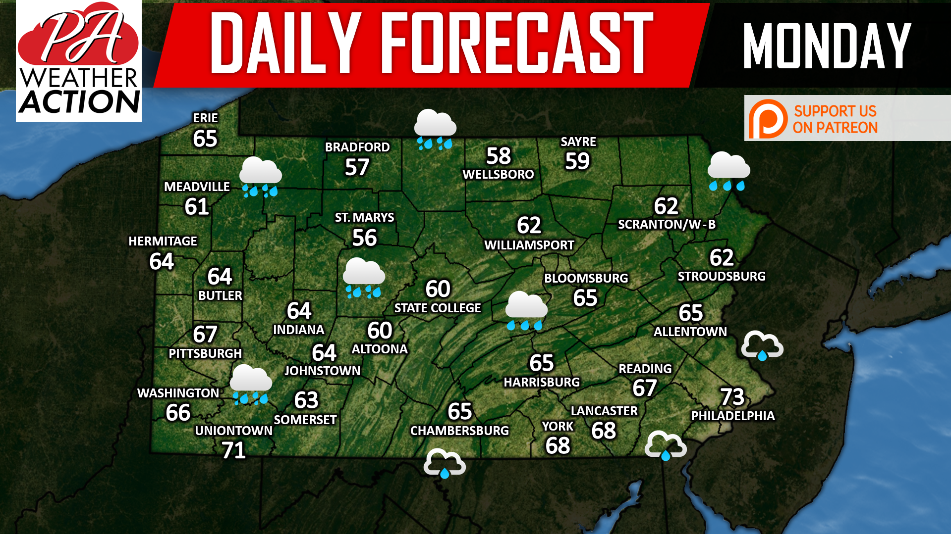
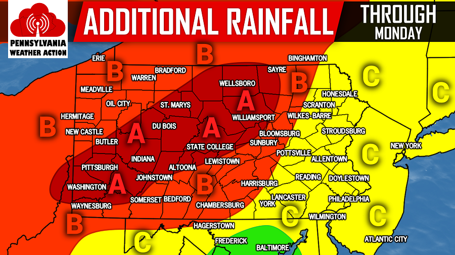
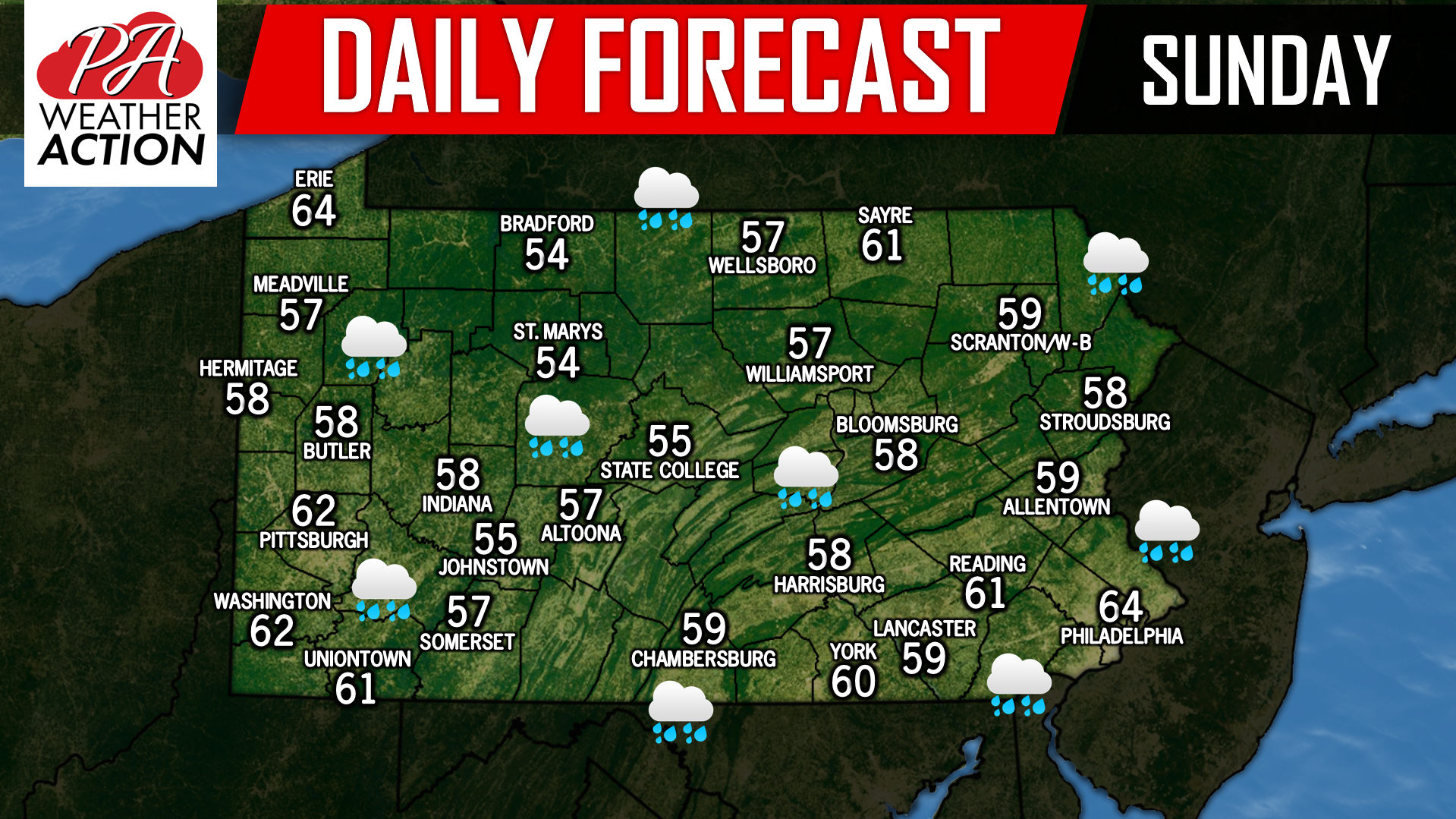
A few showers are possible this morning in south-central and east-central PA. Clouds will continue to linger in southern and eastern PA through the day. Partly sunny skies are likely in western and northern PA, with highs around 80 state-wide.
We are now a little more than 24 hours from Hurricane Florence making landfall along the North Carolina coastline. Currently, Hurricane Florence is a Category 3 hurricane with wind speeds sustained at 115 MPH. Over the next 24 hours, it is expected to strengthen before it makes landfall. Unfortunately, there is little doubt now that…
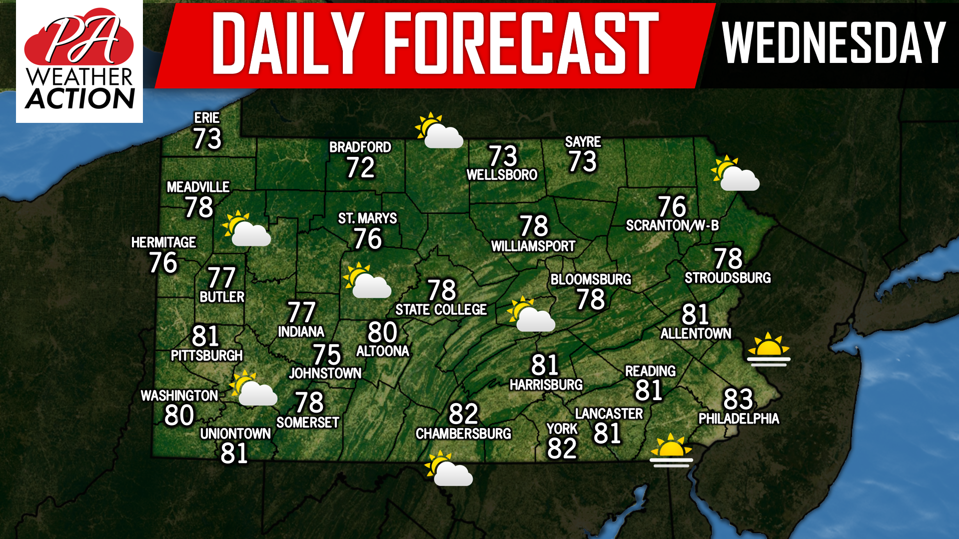
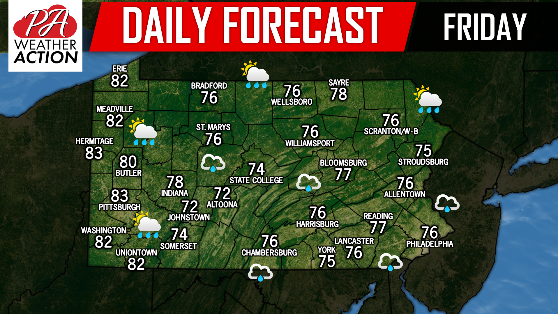
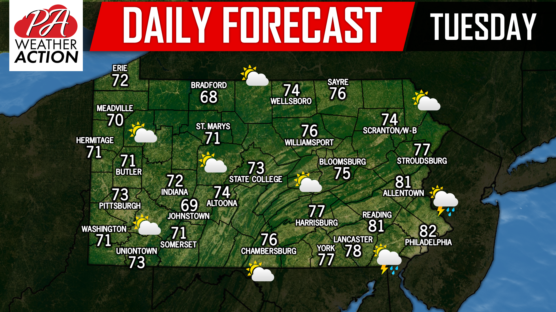
Mostly cloudy skies today are expected with the chance for scattered showers. A forecast very similar to yesterday’s. Peaks of sunshine are possible if your town is able to luck out this afternoon. If you missed yesterday’s updated forecast from us regarding Hurricane Florence’s impacts, click here: https://paweatheraction.com/major-hurricane-florence-may-make-two-separate-destructive-landfalls-in-nc-sc For now, here is the latest forecast track…
At this point we know Major Hurricane Florence will bring catastrophic impacts to the Outer Banks and Coastal NC. What still remains unclear is where the storm will track after making landfall or near-landfall. Latest runs of the GFS and Euro suggest the storm may not even fully come ashore in Southeast NC before moving…
After a dreary start for many areas this morning, there is the potential for some peaks of sunshine today with temperatures in most areas in the 70s. There is the chance for scattered showers and storms to develop over our southeastern counties this afternoon, but this does not appear to be a big threat. We…
Major Hurricane Florence is now only a few days away from landfall in North Carolina. Models have come to a consensus that landfall will be between Wilmington, NC and Ocracoke, NC. It will likely make landfall as a category four storm, with winds of 140 MPH. Here is the latest track from the National Hurricane…
A steady moderate rain is expected in western and northern PA today, with scattered showers likely in southern and eastern parts of the state. Highs will be in the 60s across the state. Stay tuned for an update on Hurricane Florence this evening.
Remnants from Tropical Storm Gordon is sure living up to its potential over the last 36 hours. Places across Pennsylvania have already received 3 to 6 inches of rainfall. Just about everywhere in the state is under some sort Flash Flood Warning/Watch or Flood Watch. Take a look below at the latest advisories issued by…
Heavy, soaking rain is expected to continue across the state today with temperatures in the 50s and 60s. Every county, but Erie county is under a Flood Watch and/or Flash Flood Warning. In most places, 1 to 4 inches of rainfall has already fallen since yesterday with another 1 to 4 inches of rain expected…
You must be logged in to post a comment.