Josh Adams is the founder and lead forecaster of Pennsylvania Weather Action, a regional forecasting site he launched in 2015. With over a decade of experience analyzing weather patterns across Pennsylvania, his forecasts have reached millions of readers throughout the state.
Josh specializes in Pennsylvania’s complex microclimates and terrain-driven weather patterns, providing detailed coverage of severe thunderstorms, winter storms, and flooding events. His forecasting focuses on delivering precise, timely information to help Pennsylvanians stay informed and prepared during impactful weather.
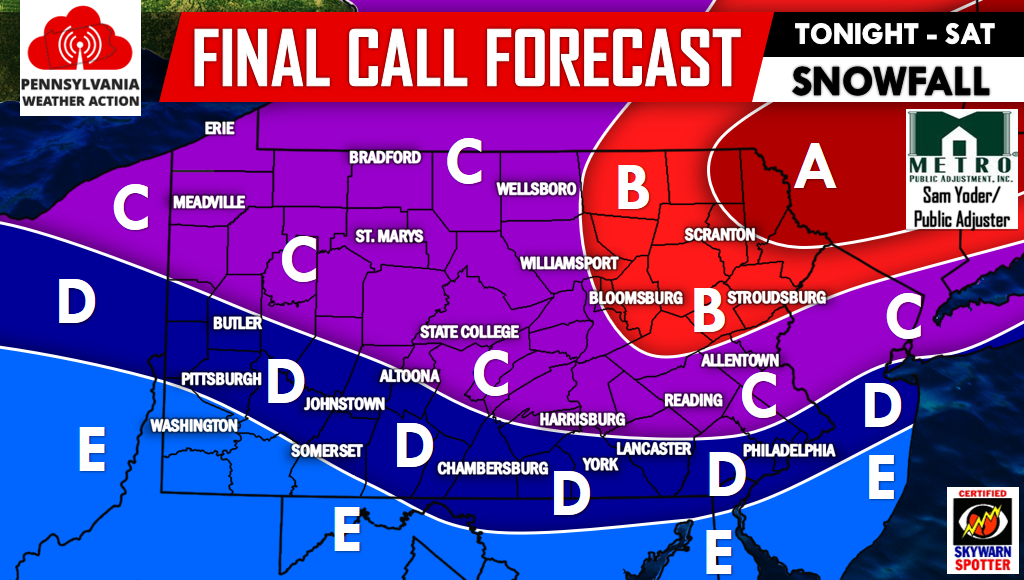
Last Updated: March 10, 2026
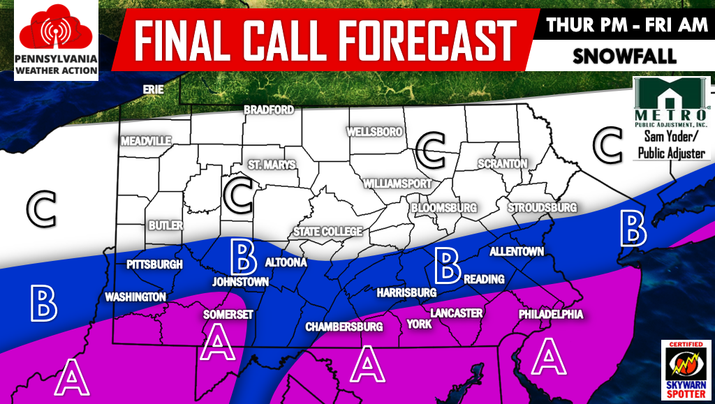
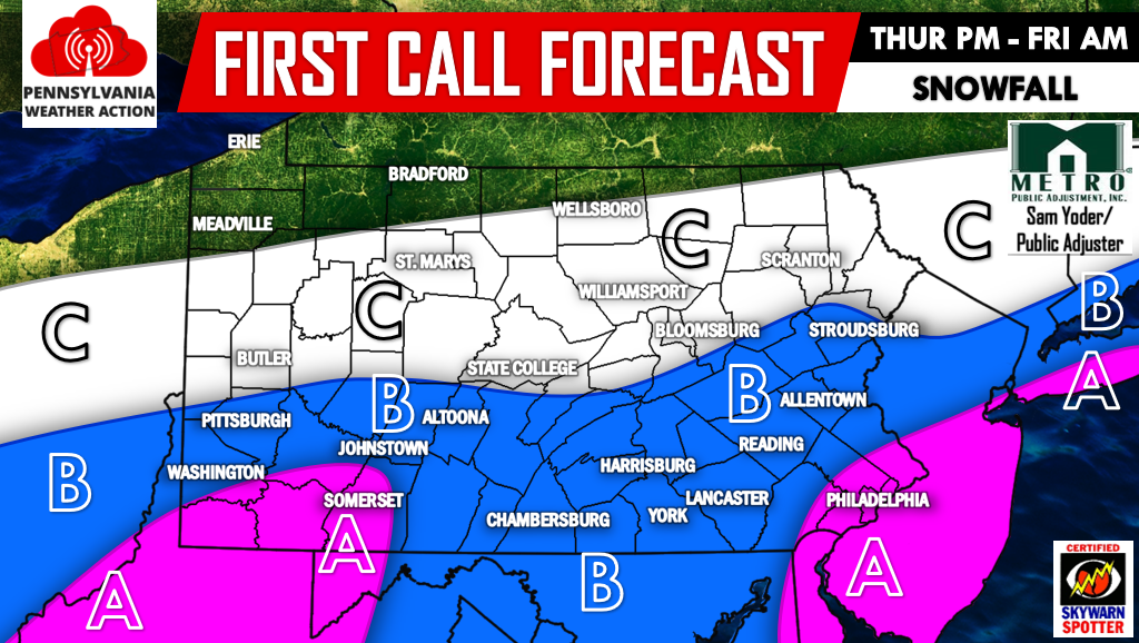
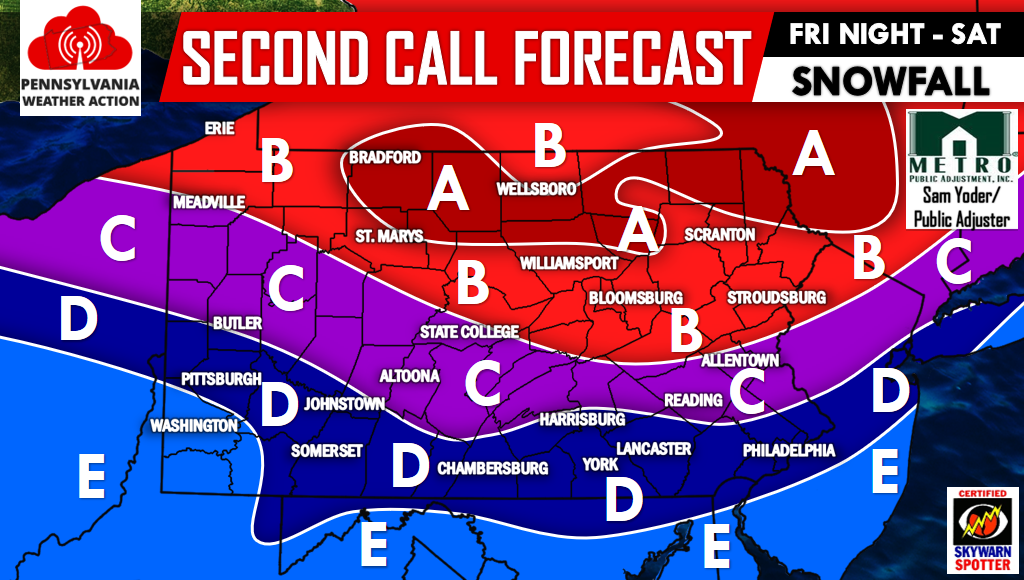
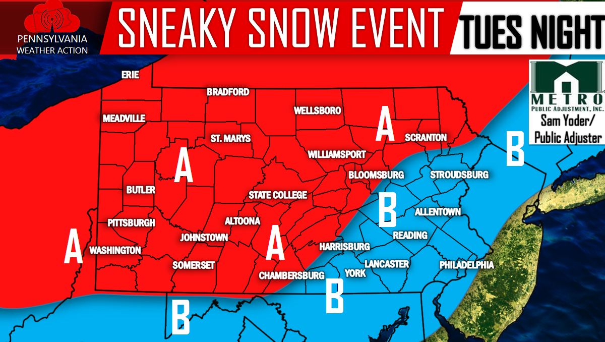
Since we have released our first call yesterday evening, guidance has suggested upper air temperatures to be a tad bit warmer than previously expected. What…
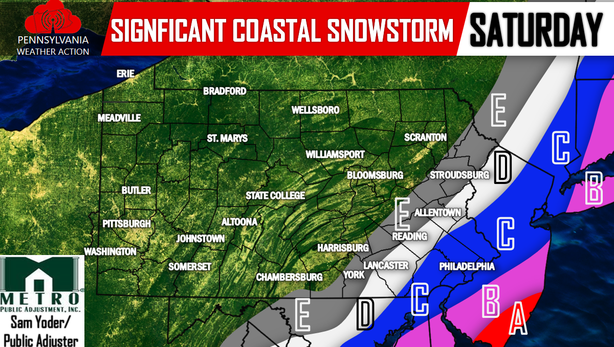
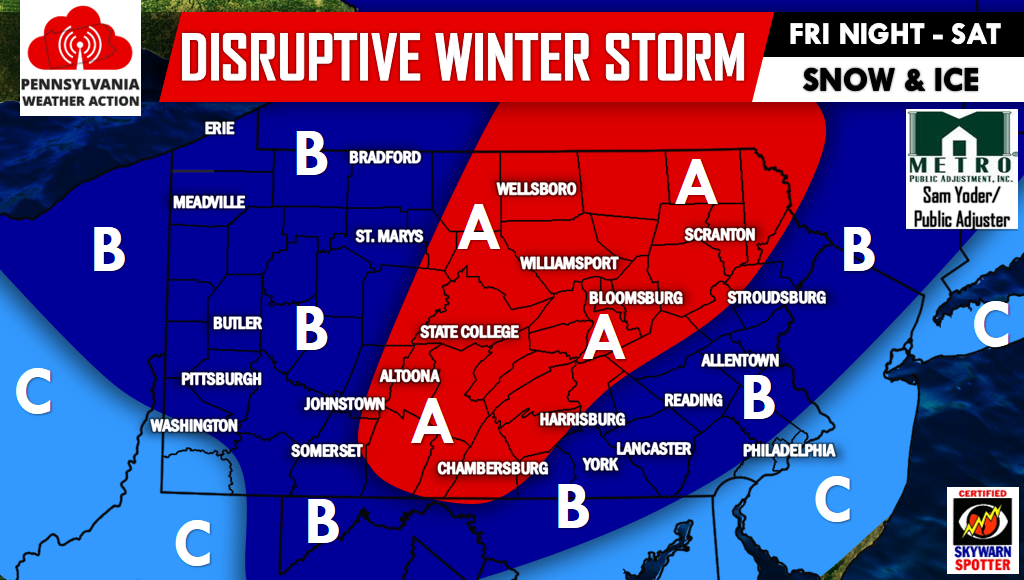
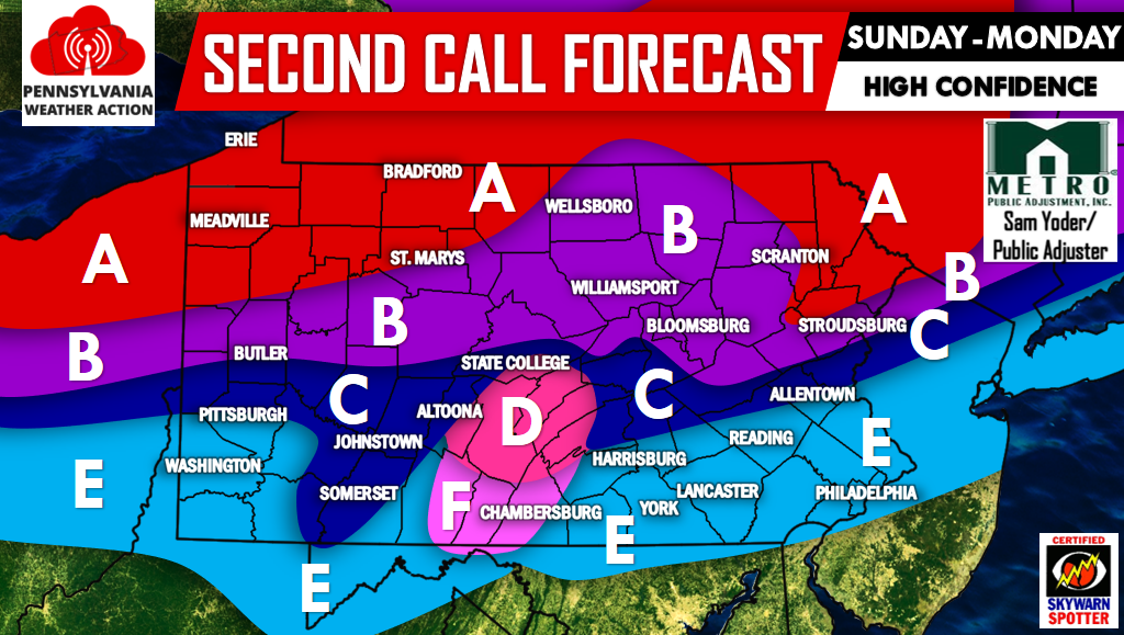
There is now the threat of a widespread ice storm in Central and Western Pennsylvania. While upper levels warm Saturday Morning, moderate precipitation will continue…
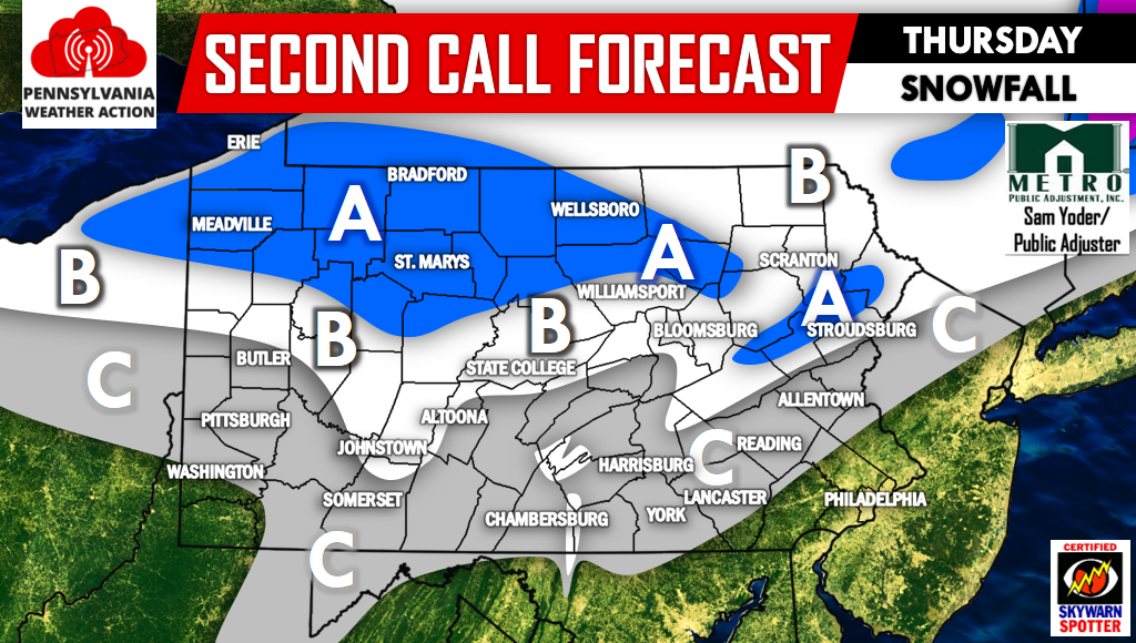
A Winter Storm will move through the area Sunday into Monday. Here's what you can expect for timing, accumulations, and road impacts. MAP FORECAST FOR…