

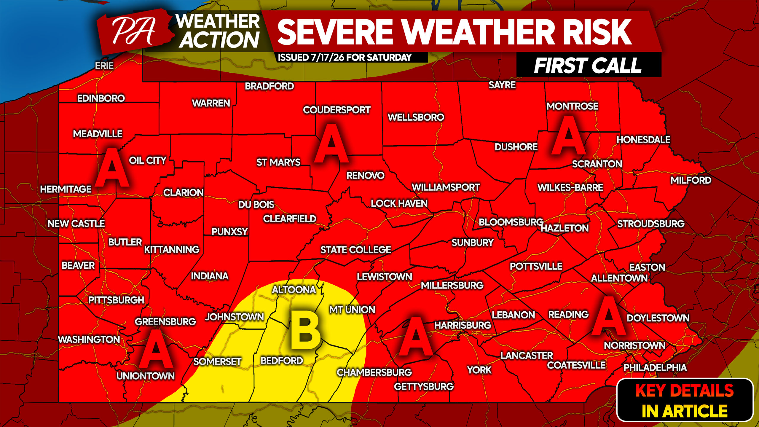
After a break from the wild rounds of severe weather the state experienced around July 4th, severe thunderstorms look to return Saturday as the smoke burns off.
A low pressure system making its way across Southern Ontario will place us in the warm sector with an unstable environment. The two wild cards are wildfire smoke exiting the state from west to east that may place a cap on the atmosphere in Eastern PA. In addition, morning rain in Eastern PA may weaken instability and prevent afternoon supercells from firing up.
Forecast confidence is highest in Northern and Western Pennsylvania for widespread thunderstorms, some of which may be severe. Even timing is relatively up in the air just 24 hours before the event.
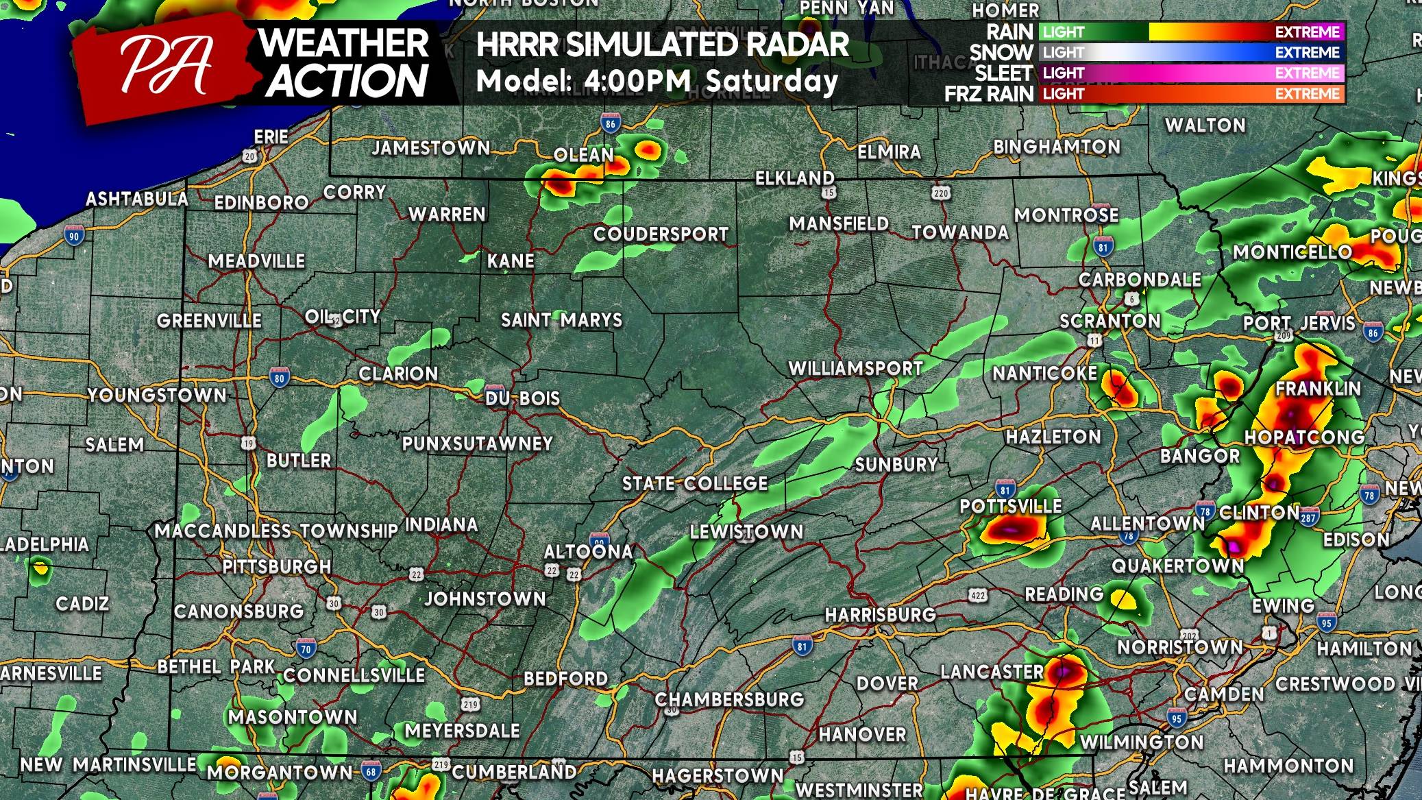
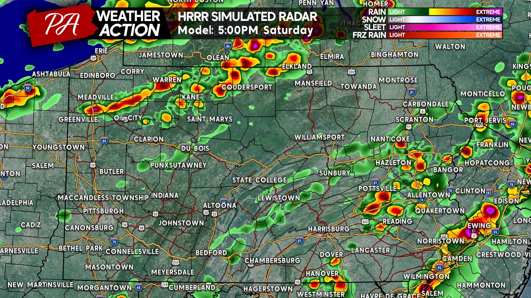
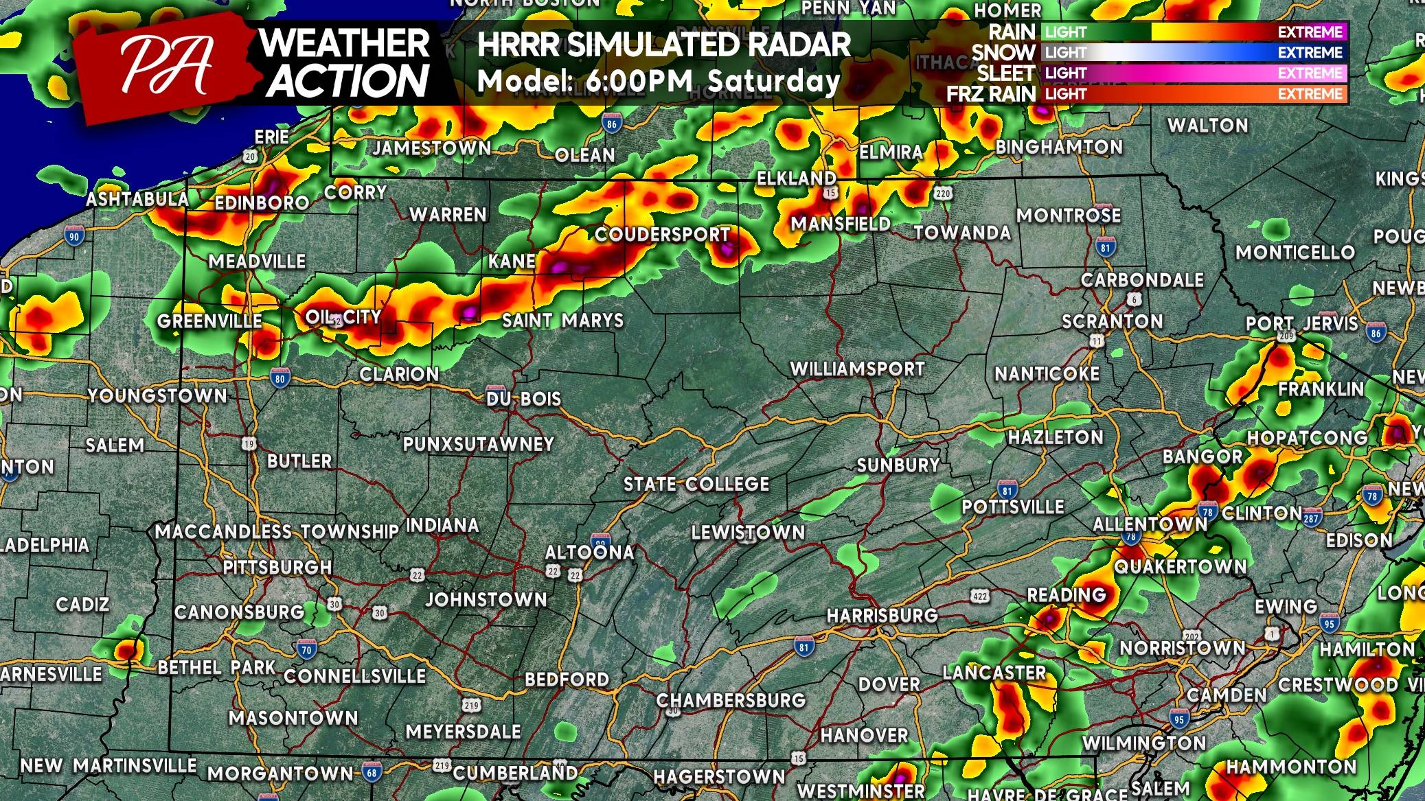
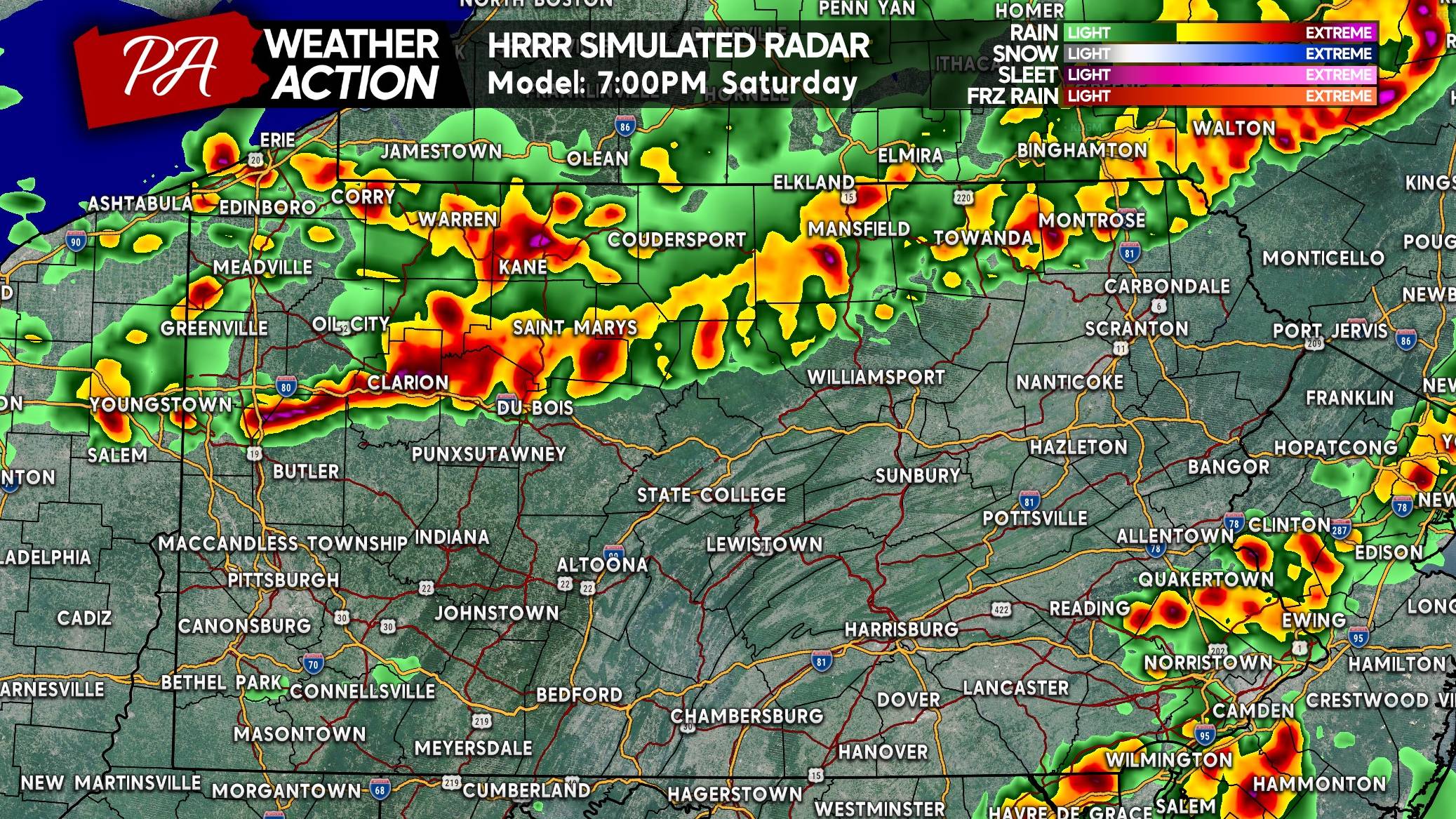
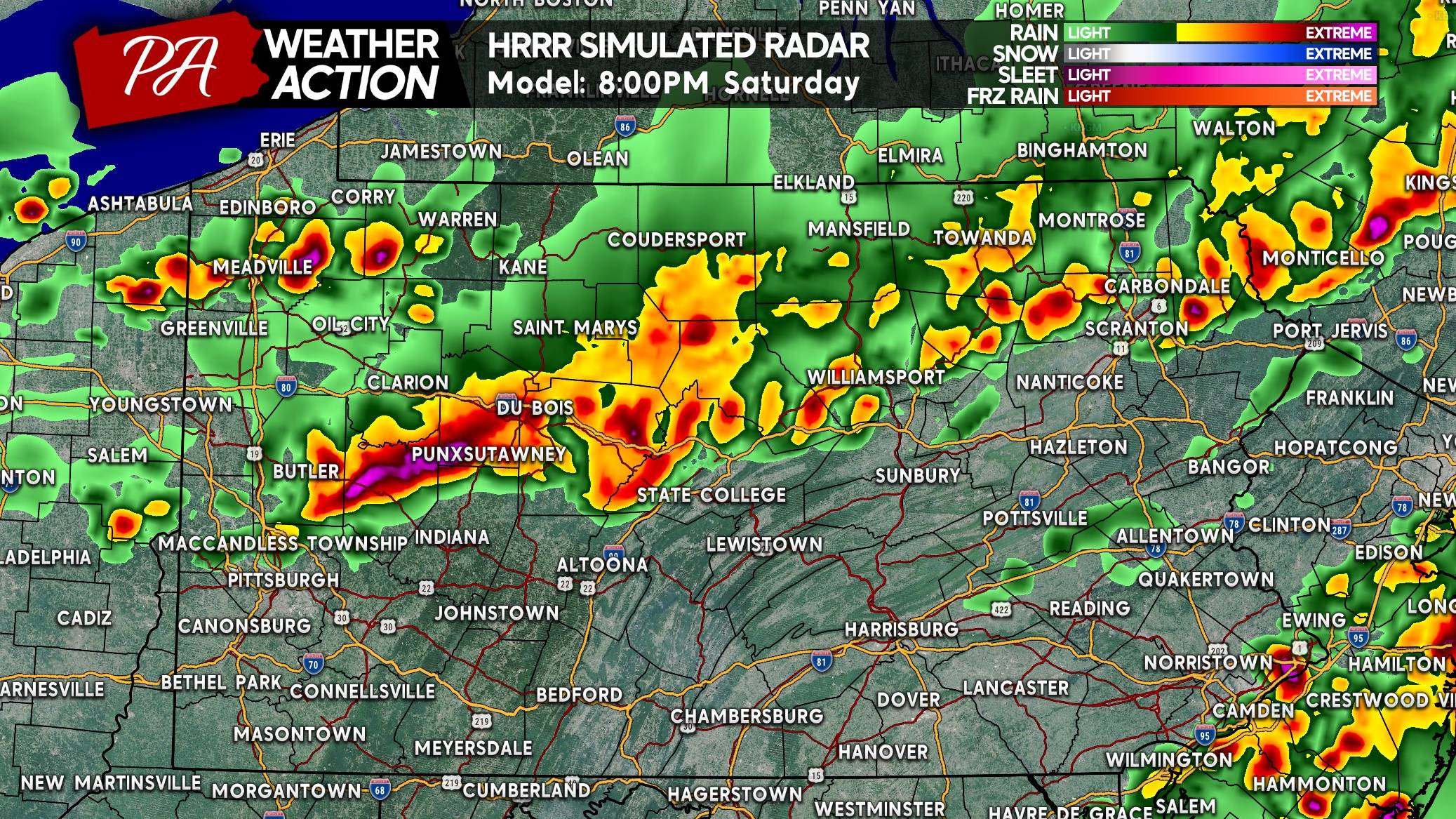
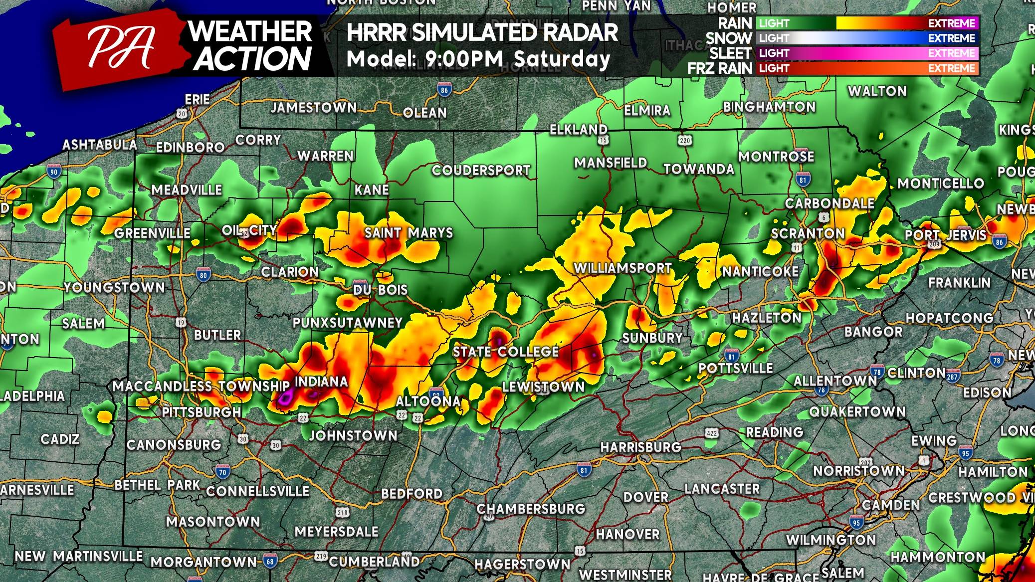
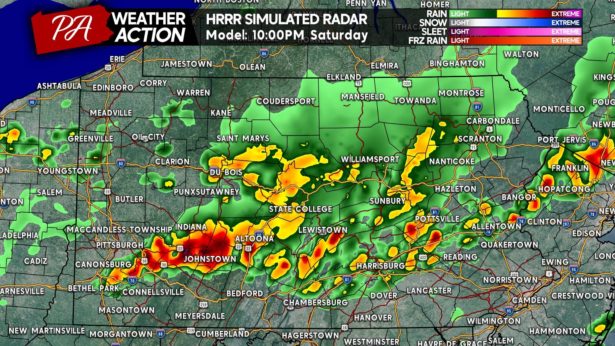
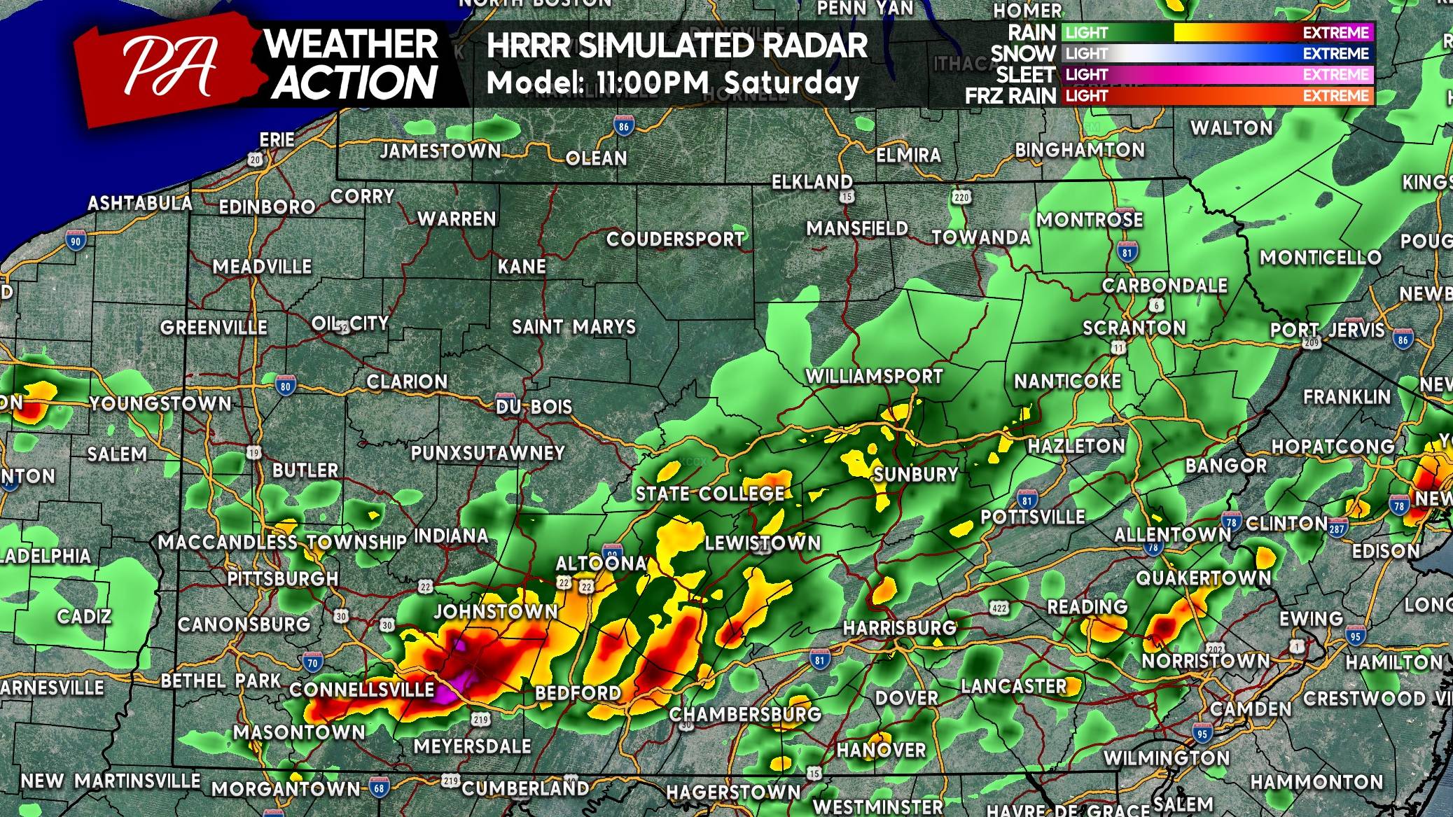
The Hi-Res NAM has much less activity in Southern and Eastern PA, the RRFS has widespread thunderstorms. The HRRR is somewhere in the middle and what we will be using for timing for this forecast.
FUTURE RADAR TIMING
SATURDAY SEVERE THUNDERSTORM THREAT FORECAST
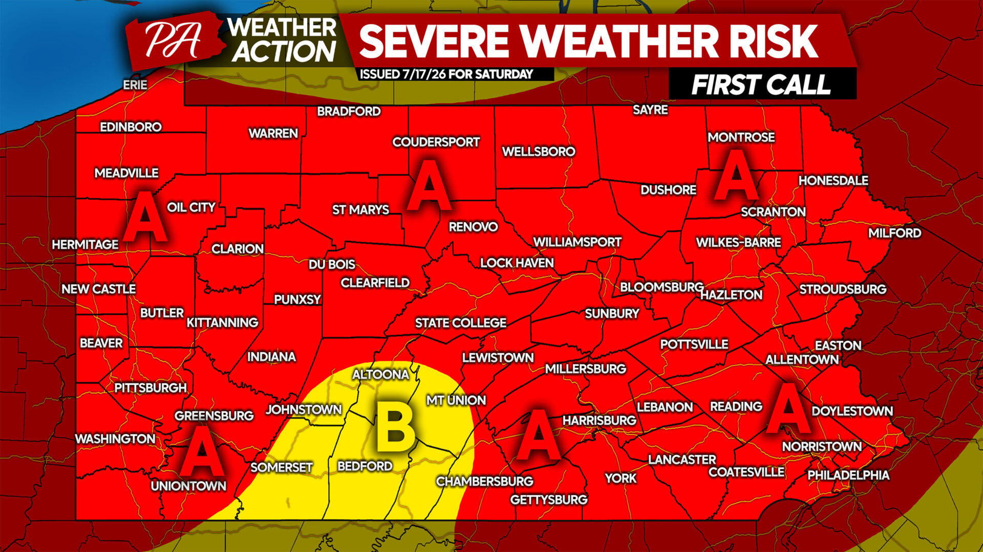
Area A: Scattered strong to severe thunderstorms expected Saturday afternoon and evening. Isolated damaging winds up to 80mph are possible in the strongest storms along with isolated tornadoes.
Area B: Isolated strong to severe thunderstorms expected Saturday afternoon and evening. Isolated damaging winds up to 70mph are possible in the strongest storms along with isolated tornadoes.
On the bright side, the wildfire smoke will be gone! Don’t forget to share this forecast with friends and family!

You must be logged in to post a comment.