
THIS FORECAST HAS BEEN UPDATED. TAP HERE FOR THE LATEST HURRICANE ISAIAS FORECAST!
Tropical Storm Isaias was officially named last night, after intense convection developed around the center of low pressure. As of 5:00 AM Thursday, the storm had maximum sustained winds of 60 MPH. Isaias may have just been declared, but this storm has been creating headaches for days. Below is the latest infrared satellite map of Tropical Storm Isaias.

As recent as Wednesday morning, model guidance suggested the storm would move over the Florida Keys and up the west Florida Coast. Things have since trended well east, and now most models suggest Isaias will not make a landfall in Florida, but perhaps in eastern North Carolina.
We are not out of the woods for more shifting just yet, especially since the system is moving over Hispaniola today, and models are likely to change based on where the new low pressure center emerges after the storm exits Hispaniola.
Isaias is likely to weaken slightly as it moves through the 10,000′ tall mountains of the Dominican Republic. It will then restrengthen Friday as it heads for the southern Bahamas. Uncertainty presents itself in regards to where it goes next. Some models, such as the European, have the system actually making a landfall in south Florida. But most hurricane models, and even most of the European ensemble members disagree.
The new consensus (for now) is for the system to turn north near Grand Bahama, miss the Florida and Georgia coast, and make or near landfall between Wilmington and Avon, North Carolina. However, the key difference now is strength.
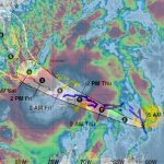
Because the storm will have more time over warm waters of the Gulf Stream, and be in a more favorable environment for strengthening off the southeast coast, the risk arises for Isaias to potentially reach hurricane strength Sunday. Then by Monday, the system will either make landfall near the Outer Banks, NC, or be off the NC Coast. Below are the latest track and strength models for Isaias as of Thursday morning.
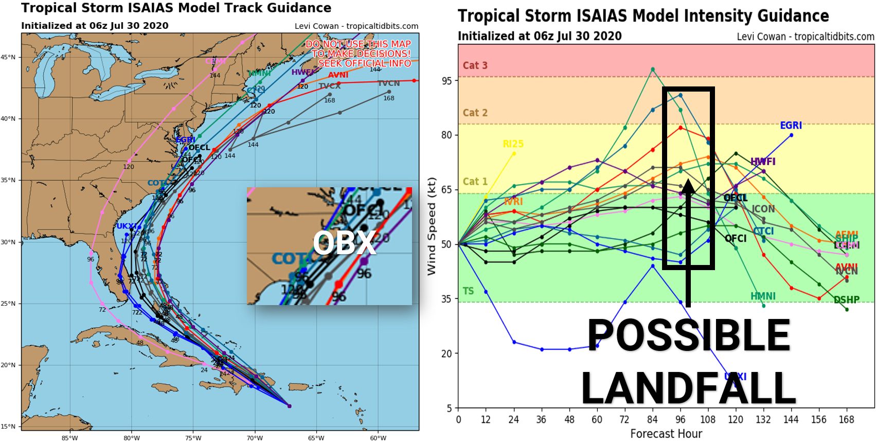
An Outer Banks landfall is far from locked in. Expect to see further changes in forecast track and intensity in the coming days. There is both the chance this storm may head into Miami, and this storm may stay far enough off the NC coast to only bring minimal impacts. However, the consensus as of now (Thursday AM) is for a strong tropical storm or low-end category one hurricane to moderately impact eastern NC and southeast VA.
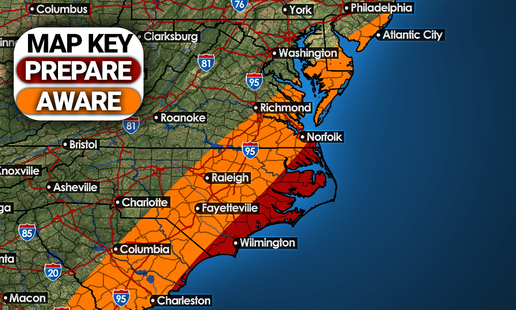
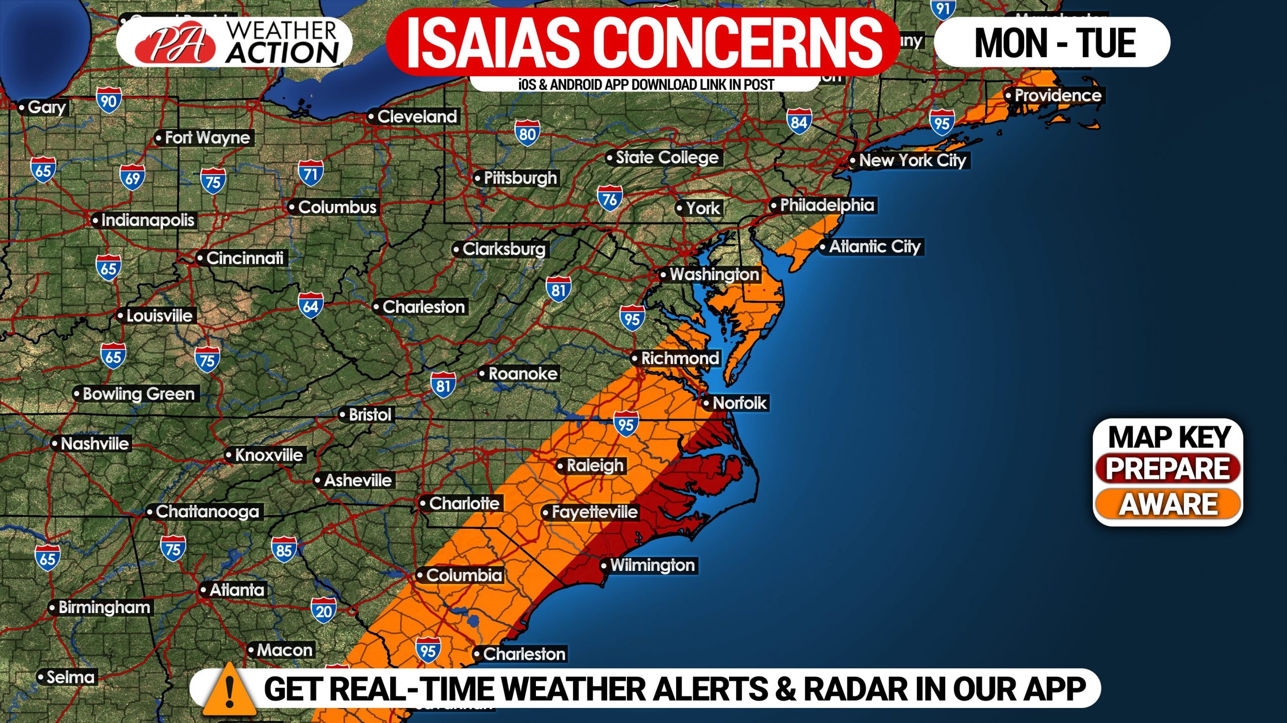
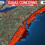
Those specifically on the Outer Banks should consider making early preparations for a potential landfall. Below is a graphic showing what areas should begin preparations, and also the areas that should be aware of Tropical Storm Isaias.
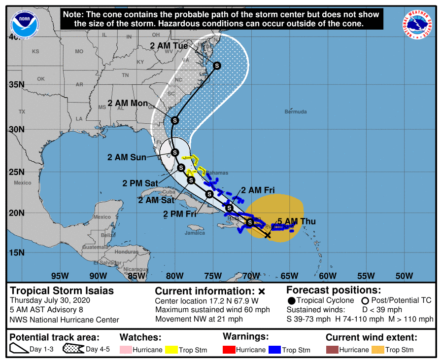
The latest track as of 5 AM from the National Hurricane Center has shifted slightly east, and the center of Tropical Storm Isaias is now projected to stay off the Florida Coast. This is no surprise given the latest model trends. The NHC then predicts Isaias will make landfall near Morehead City, North Carolina as a strong tropical storm, with maximum sustained winds of 70 MPH, and wind gusts up to 85 MPH. Here is the latest track map from the National Hurricane Center as of 5 AM Thursday.
This forecast track will change some in the coming days. We will have these updates every morning leading up to the potential landfall of Isaias.
Be sure to share this important update, especially with those in possible impacted regions.
You can download our iOS & Android app to stay ahead of Isaias as well. Get it here >>> Weather Action App
You must be logged in to post a comment.