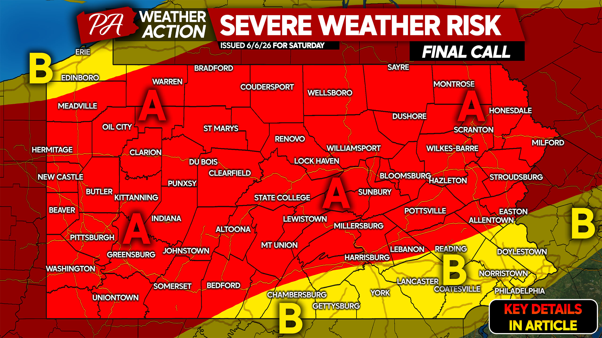
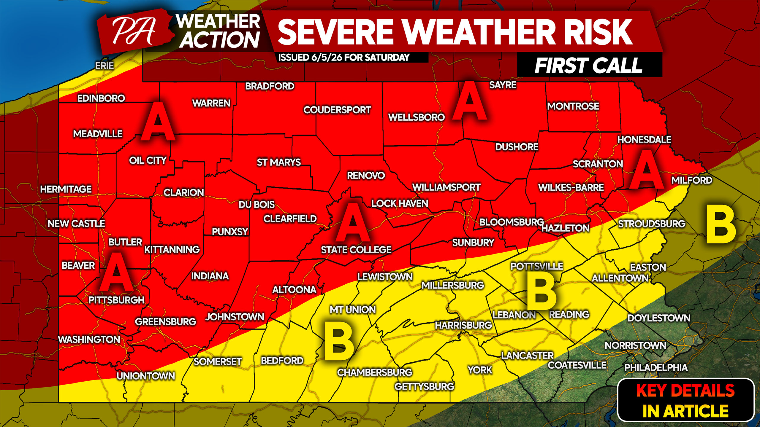
UPDATED FORECAST POSTED, SEE ARTICLE BELOW: https://paweatheraction.com/final-call-severe-thunderstorm-threat-forecast-for-todays-pa-storms/ Severe weather season has been dormant for the last few months here in Pennsylvania. We're approaching peak severe…
In quintessential Pennsylvania late spring format, temperatures well into the 90s with sunny skies to start the week will likely be succeeded by dreary conditions…
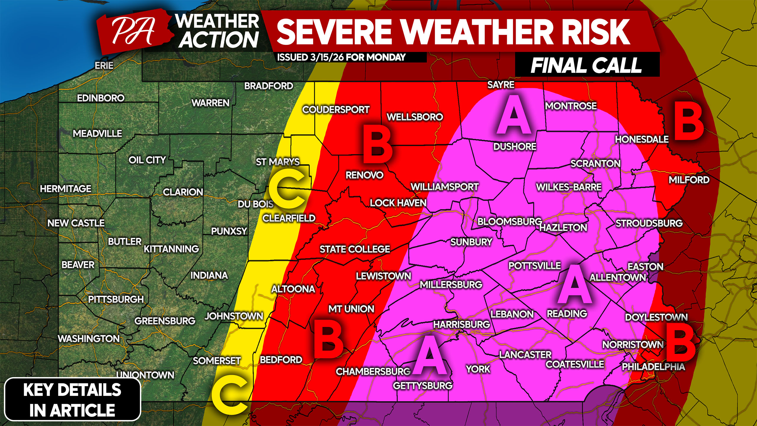
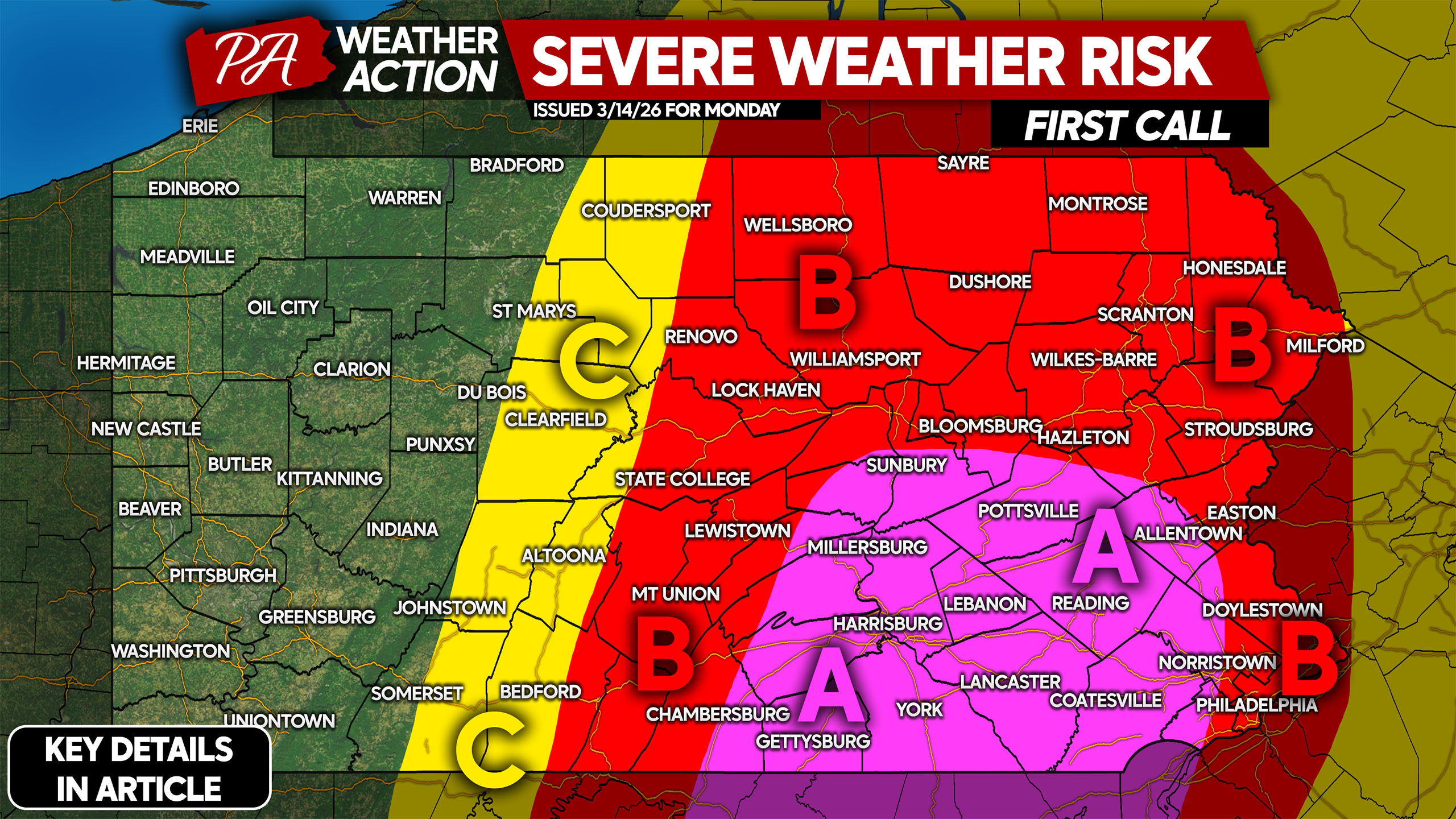
An early season severe weather outbreak is likely Monday from Pennsylvania to Georgia. Damaging winds are a significant concern, and the threat of spin-up tornadoes…
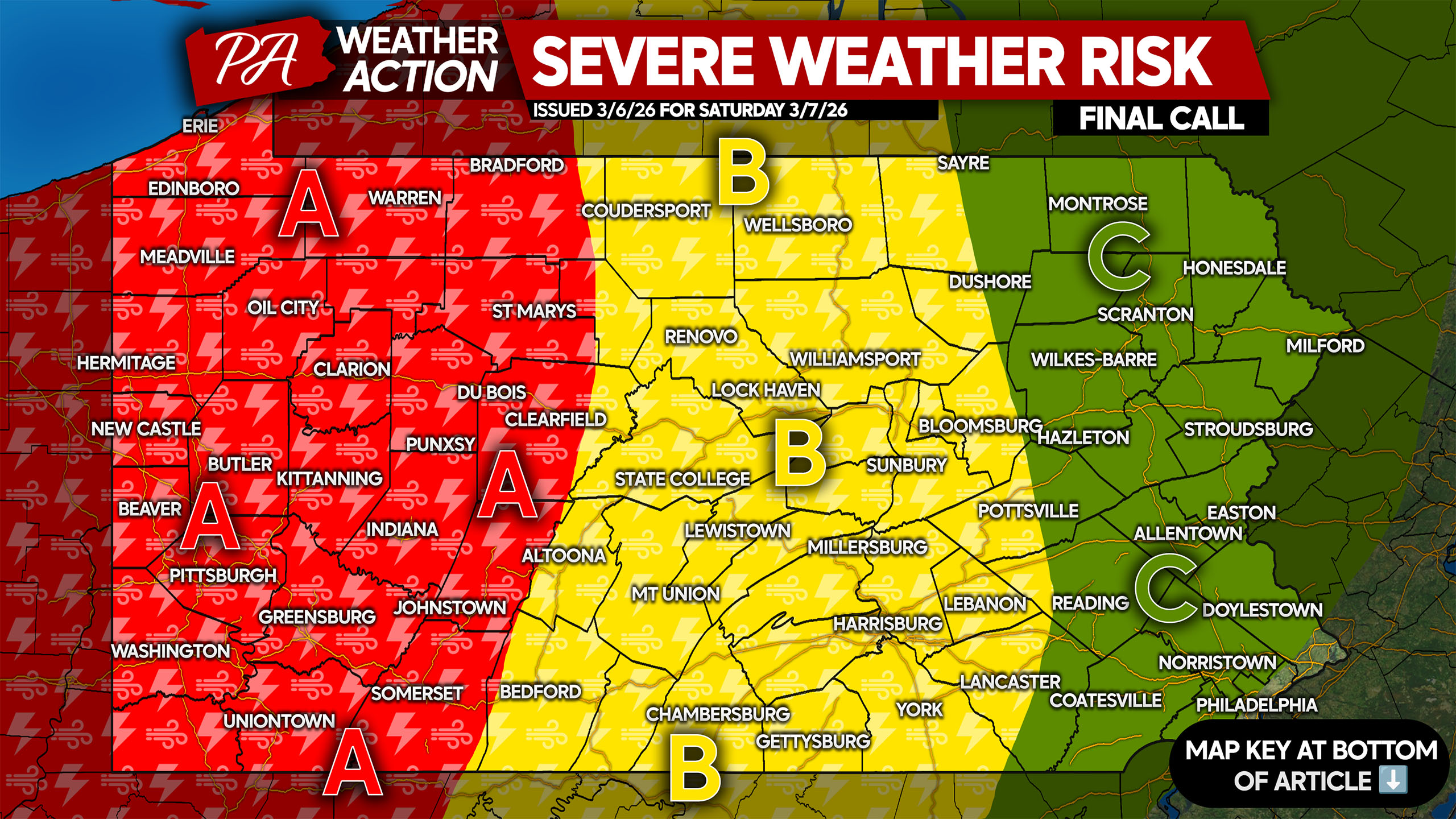
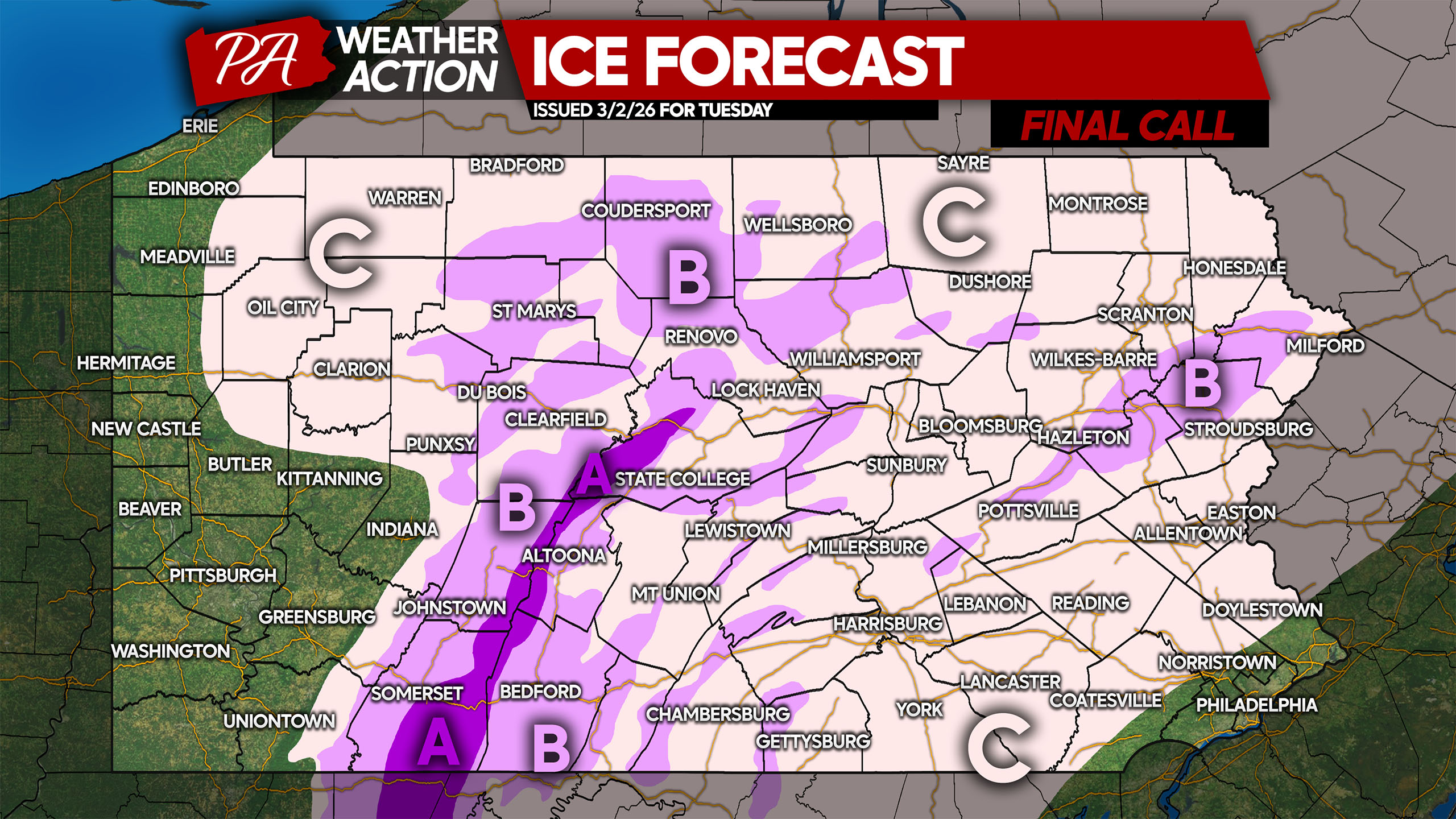
March brings the most diverse weather to Pennsylvania, with anything from snowstorms to severe weather possible in this transition month. With the pattern flipping to…
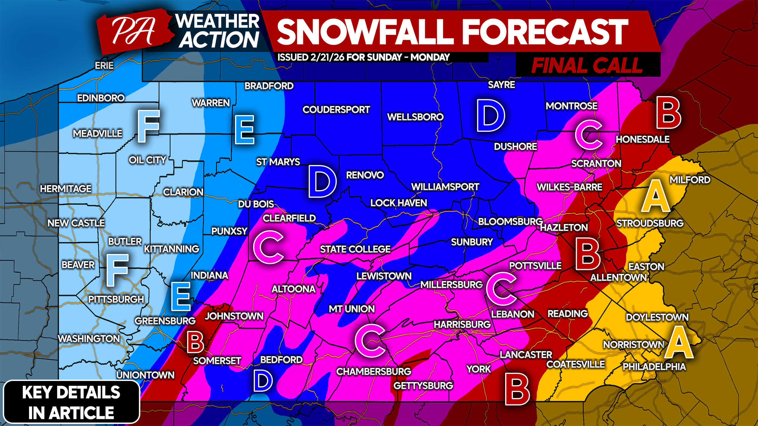
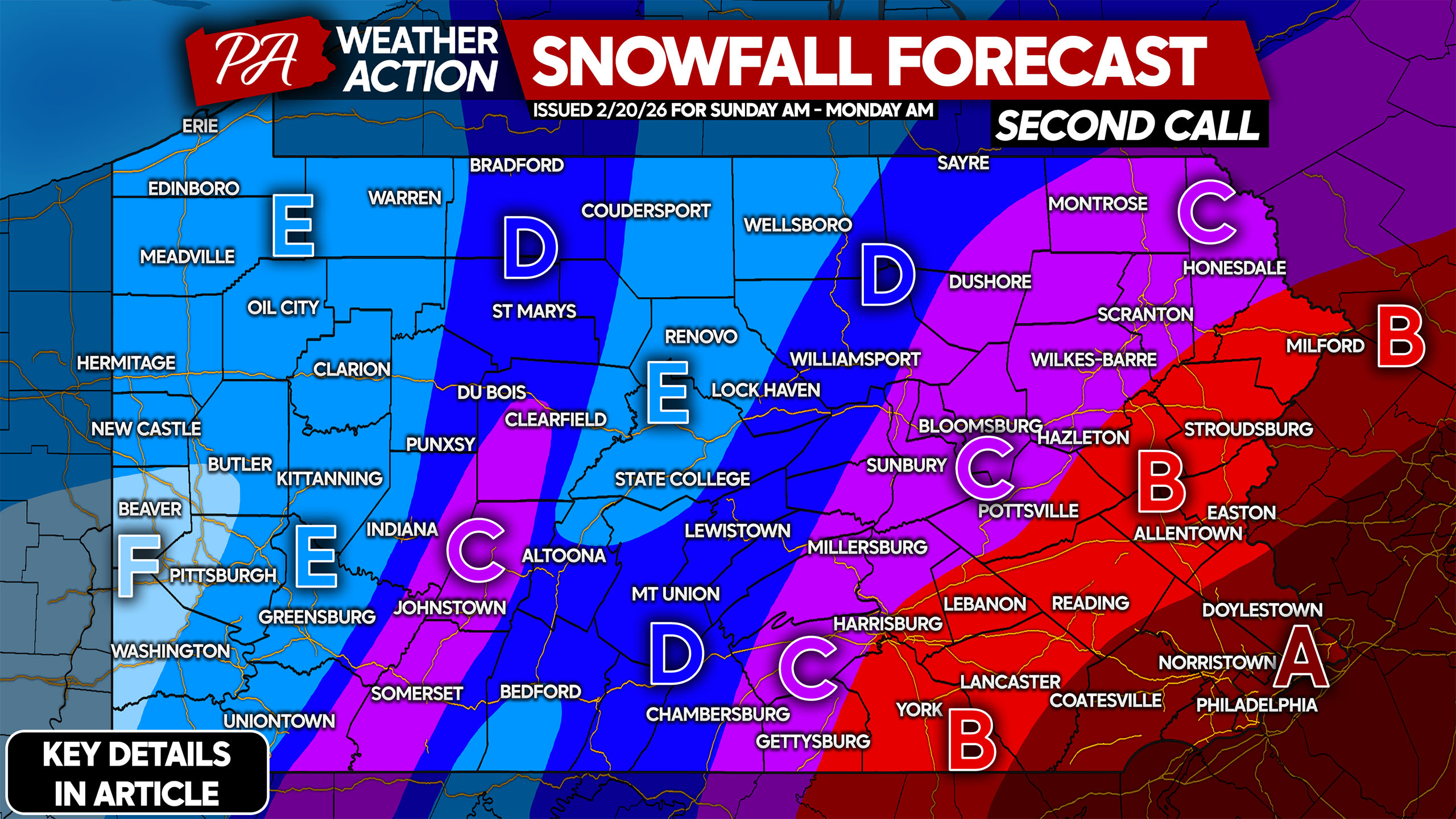
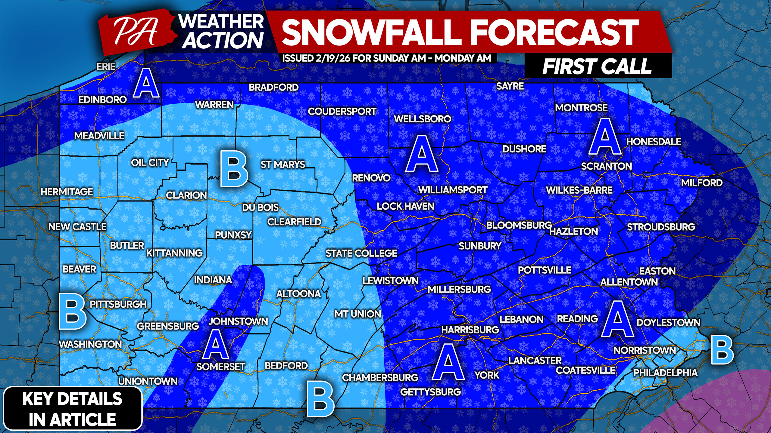
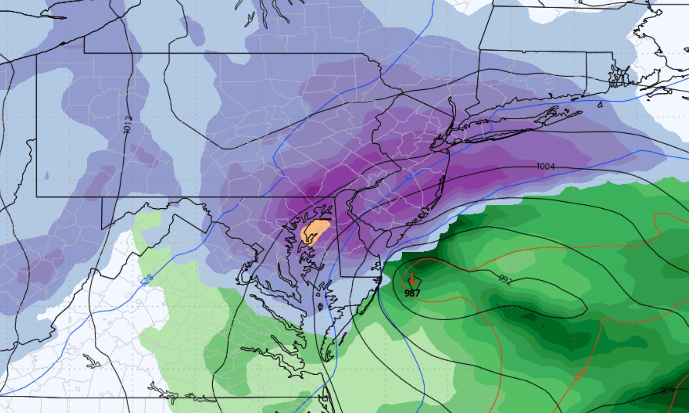
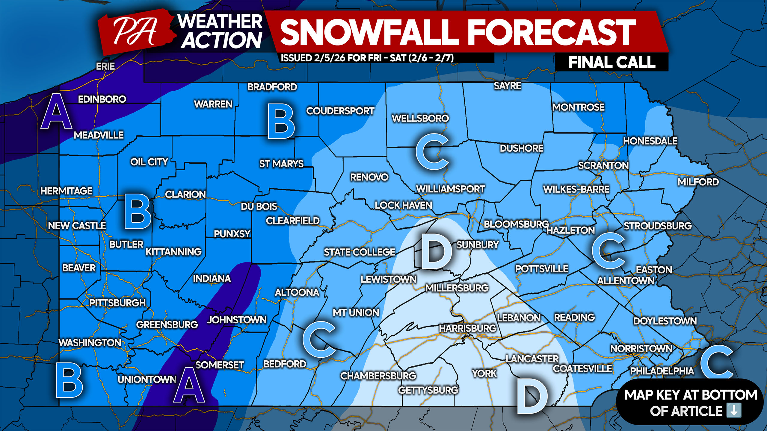
FINAL CALL POSTED: https://paweatheraction.com/final-call-snowfall-forecast-for-sundays-major-snowstorm-in-parts-of-pa/ After one of the most shocking reversals on the weather models in years, we have gone from expecting a low-impact event…
Since December 1st, Pennsylvania has experienced the coldest temperature anomalies of any state in the Lower 48. The second half of winter will likely continue…