Posted inSevere Weather Spring Weather
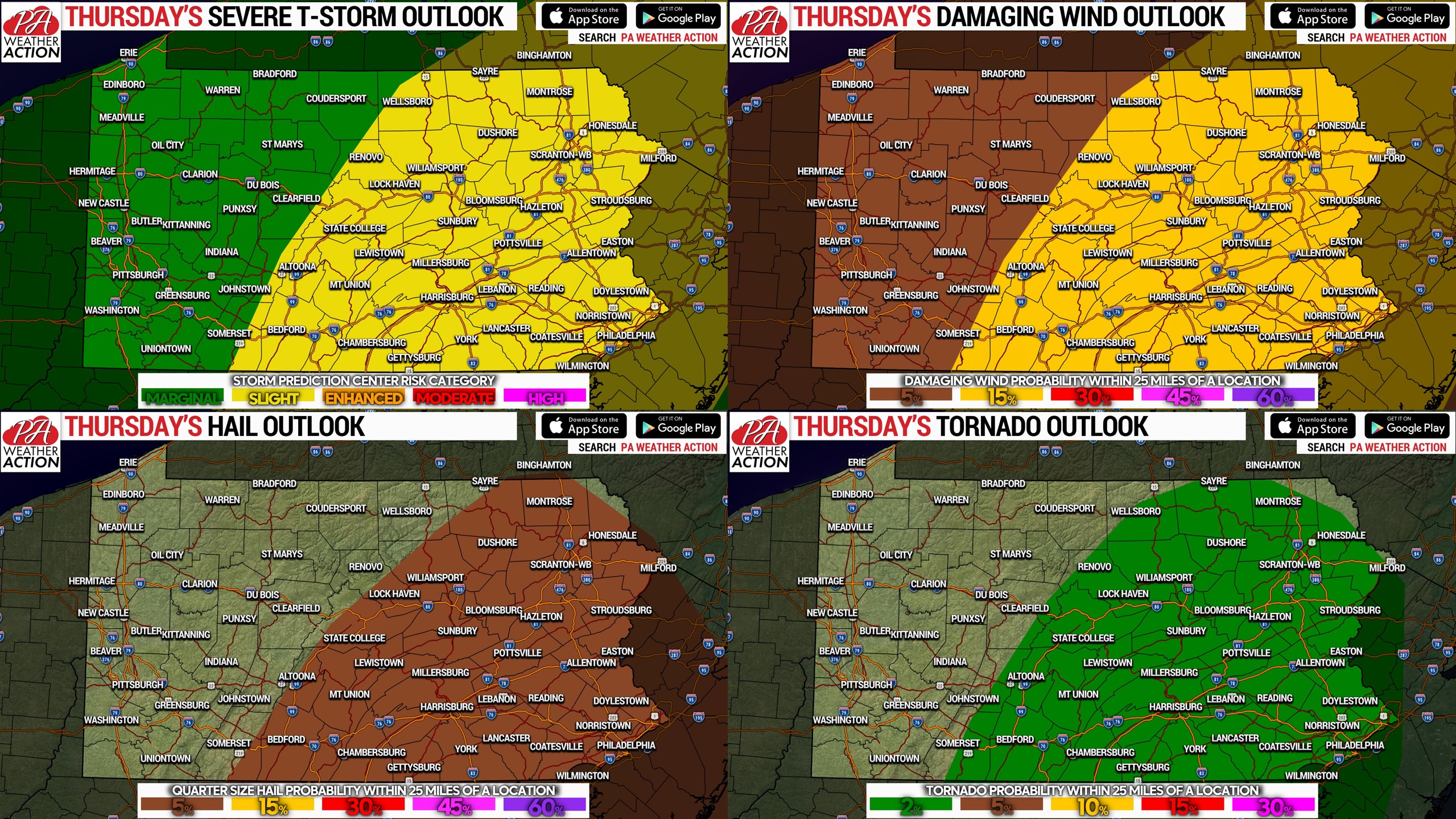
Strong to Severe Storms Poss. Today in Eastern & Central Pennsylvania; Damaging Winds, Flash Flooding, Isolated Tornado Risk
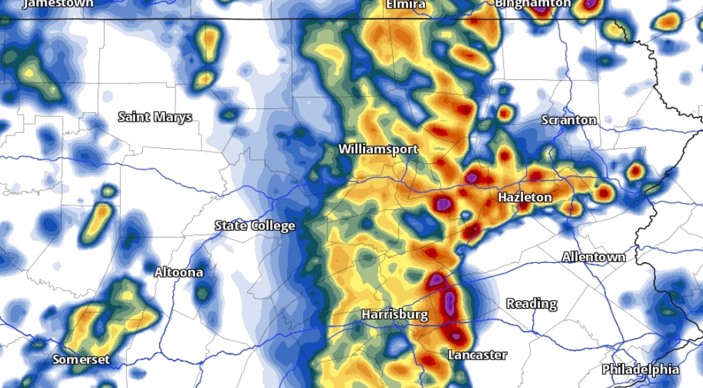
We're going to kick off Memorial Day Weekend on a stormy tone, with the possibility of severe thunderstorms in eastern and central Pennsylvania. A low…