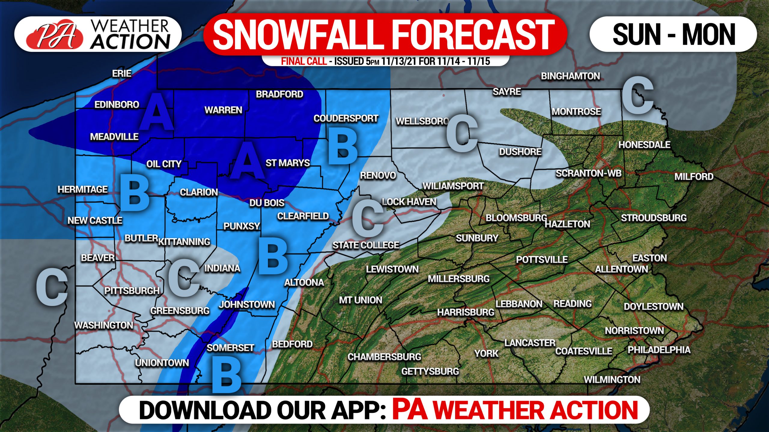
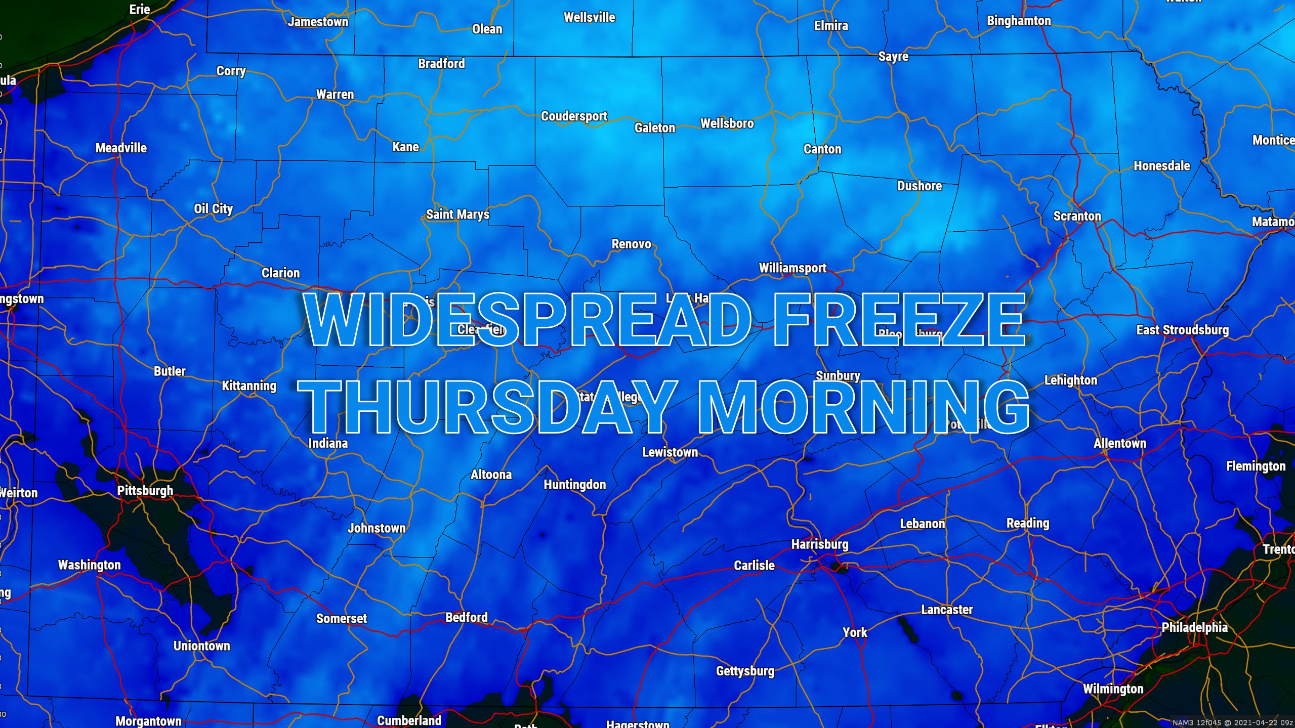
The past several days have been relatively wintry across the region, but outside the lake-effect belts roads have been fine. Another weak clipper will dive…
A weak low pressure system swinging down from the Northern Plains will make its way just northwest of Pennsylvania. Light snow showers are likely much…
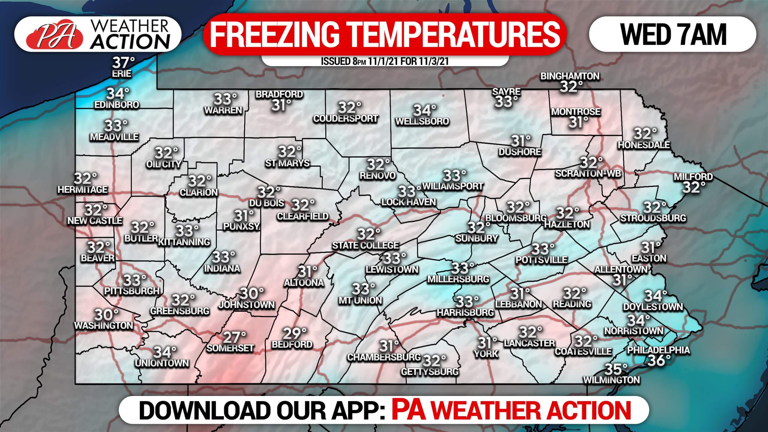
After an absurdly warm October, the pattern has flipped with the calendar. Well below average temperatures will be filtering into the region, bringing the first…
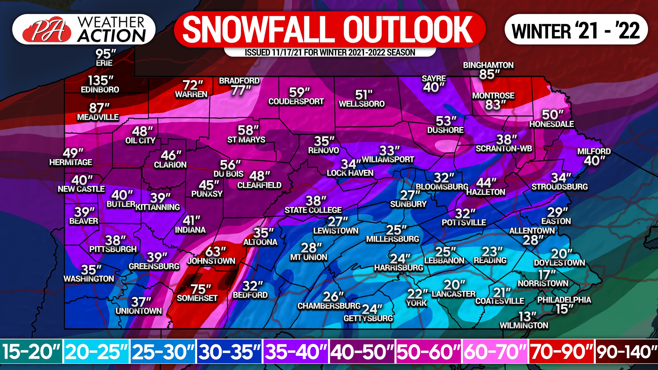
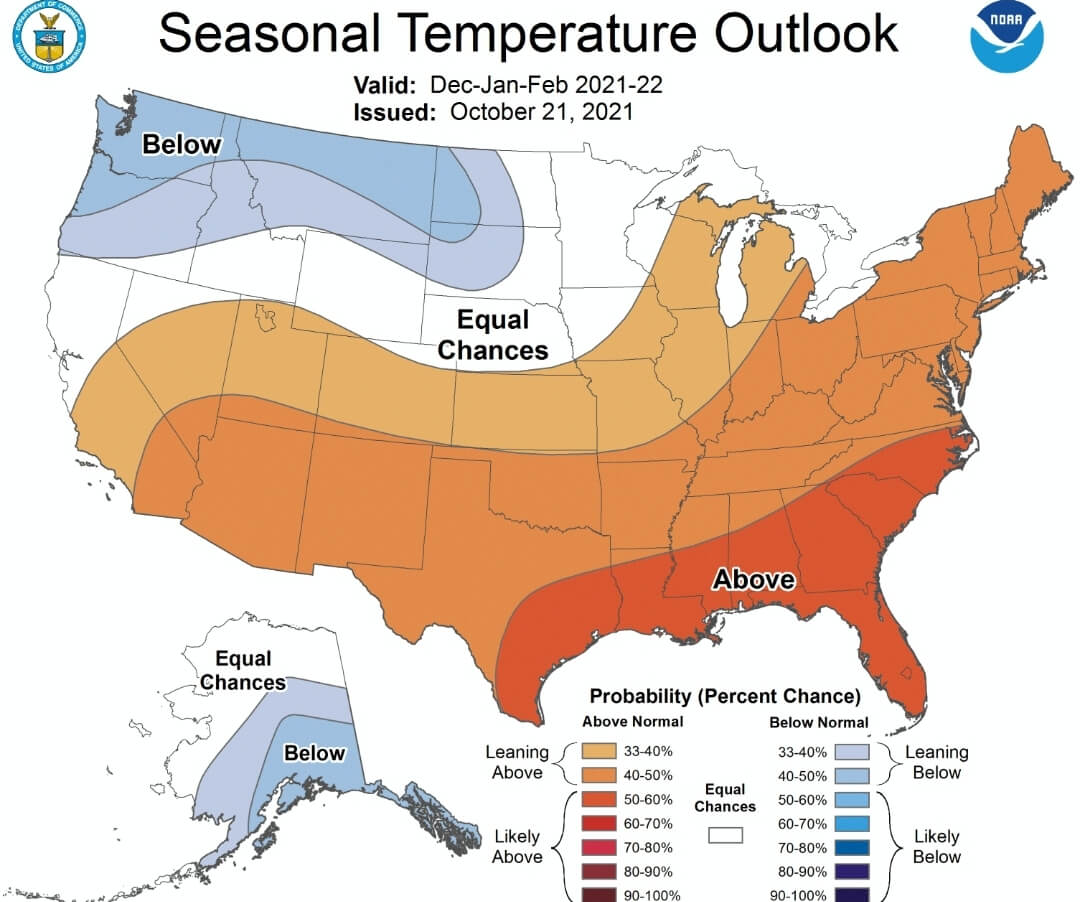
Today NOAA released their winter outlook for the months of December through February, and it's not good news for snow lovers. Above average temperatures and…
With nearly all of the Lower 48 states experiencing below average temperatures, and some areas extremely below average, you would expect us to be predicting…
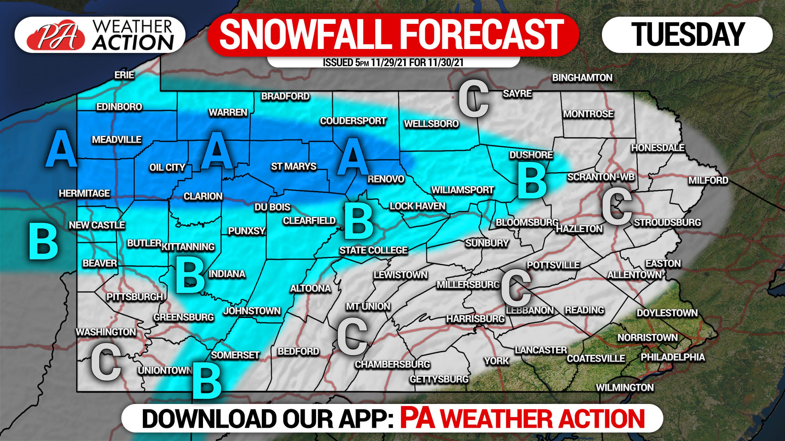
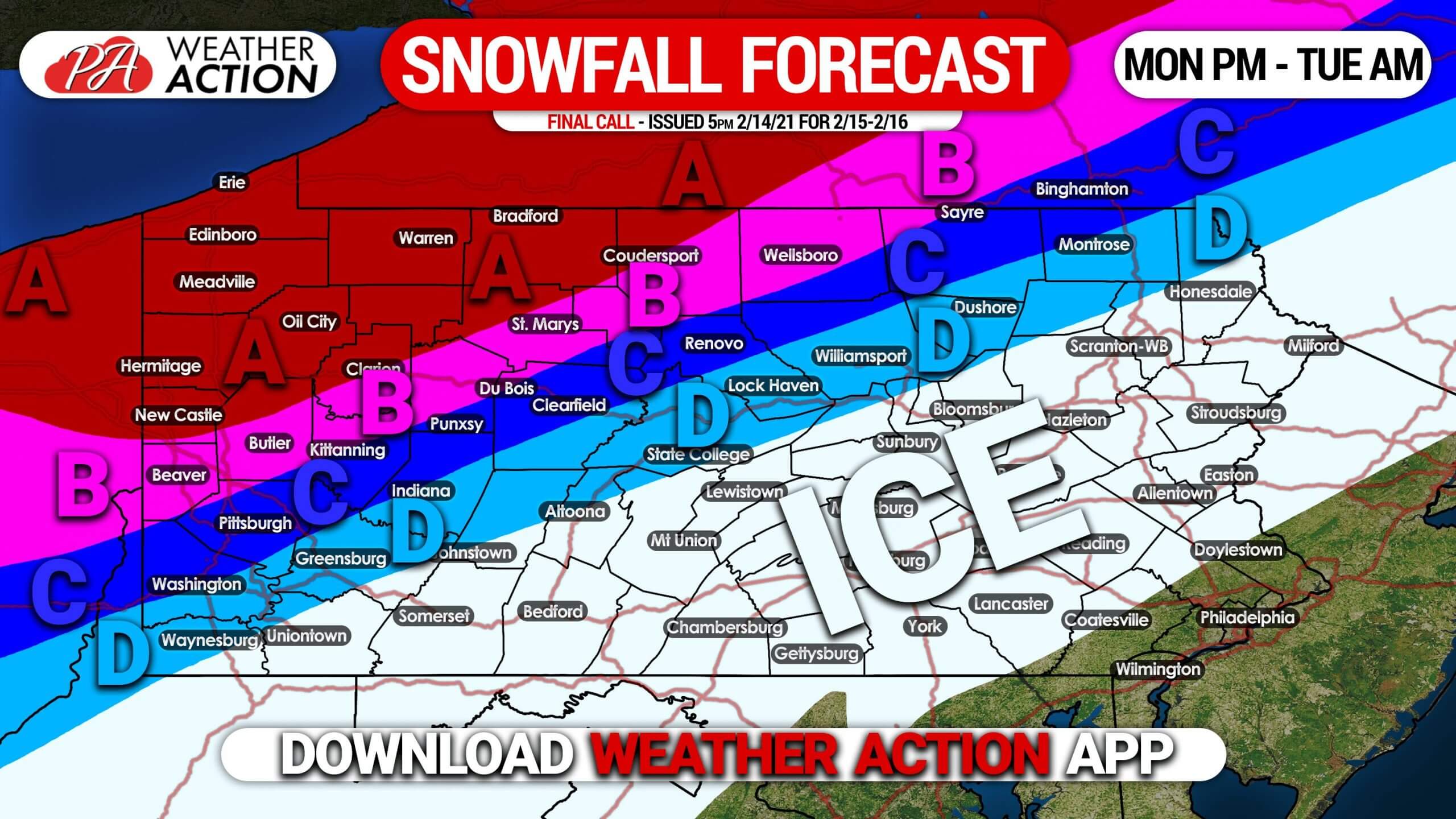
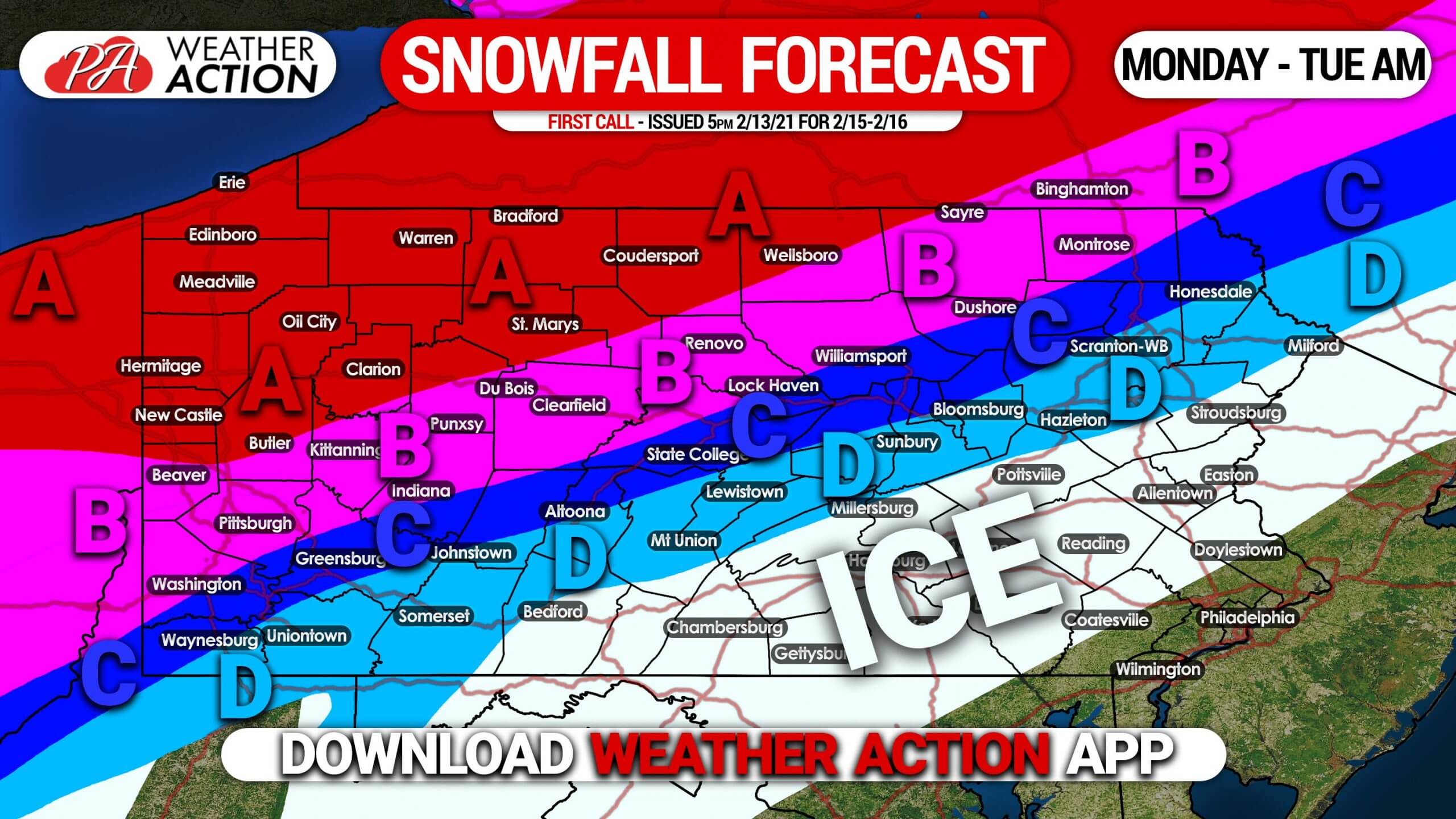
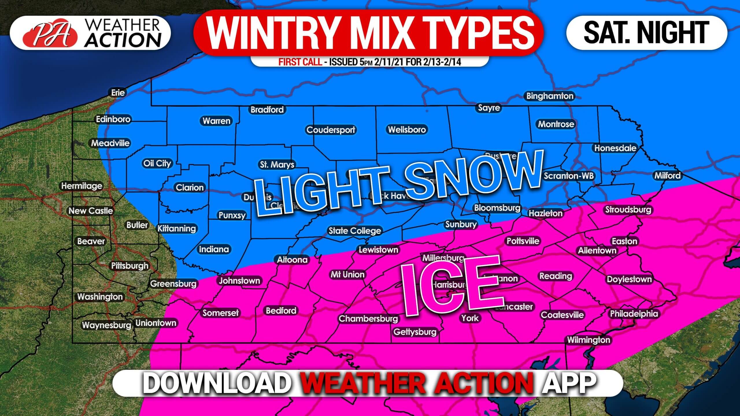
One of the most active weather patterns in decades continues, as another small winter weather event looks likely Saturday evening into the early morning hours…
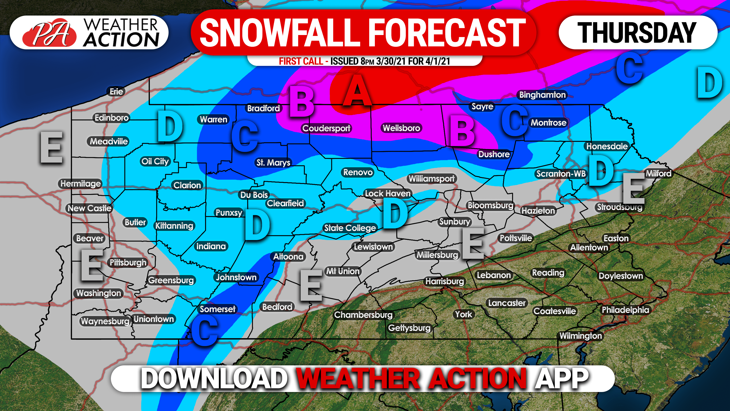
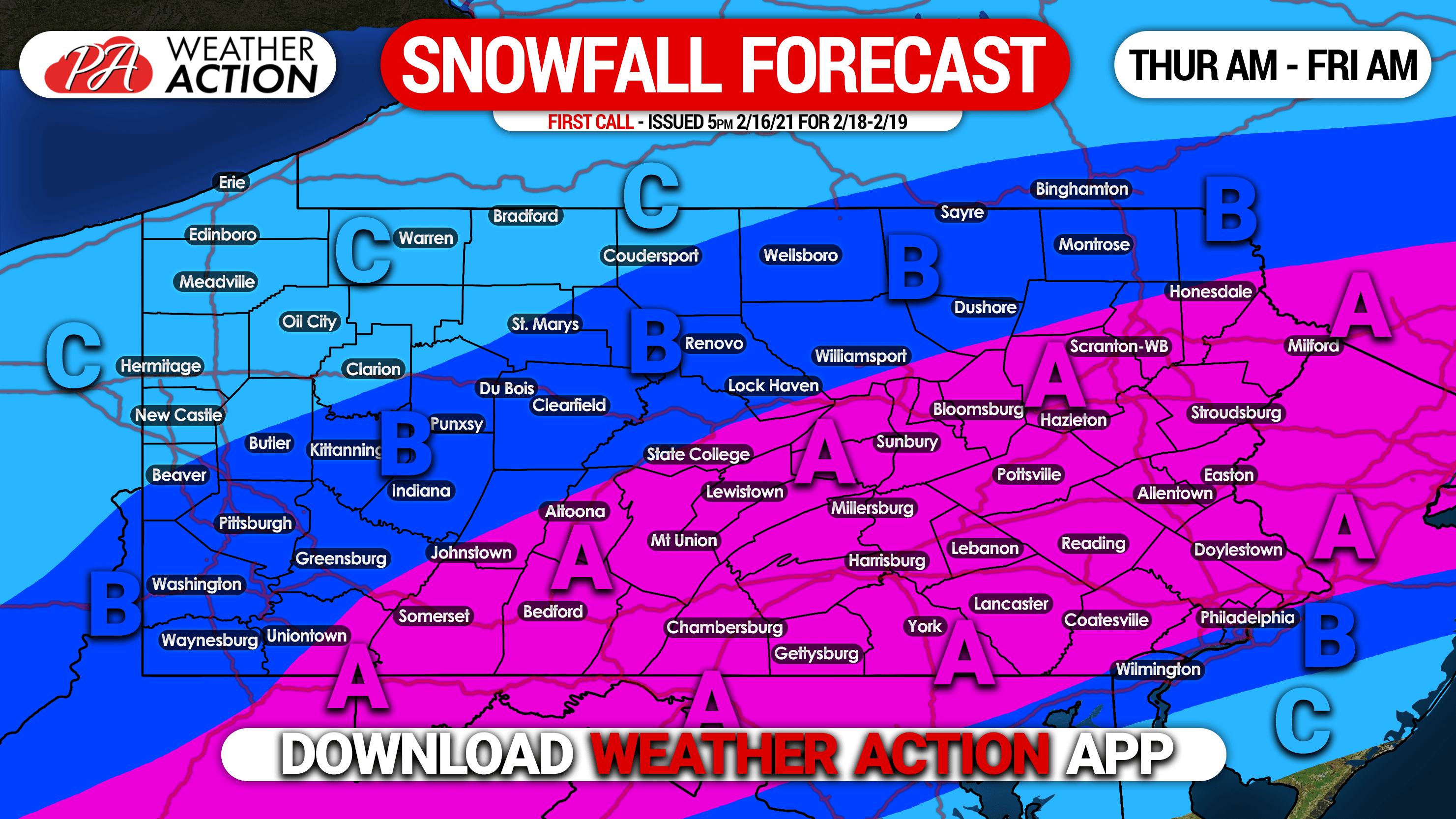
FORECAST UPDATED: Snow Amounts Increased in Final Call Forecast for Tonight – Thursday Morning’s Snow Event A weak system moving across the eastern US…