
After a dry and pleasant week of early fall weather, big changes are on the way for the weekend as rain and wind are likely to put a damper on your outdoor plans.
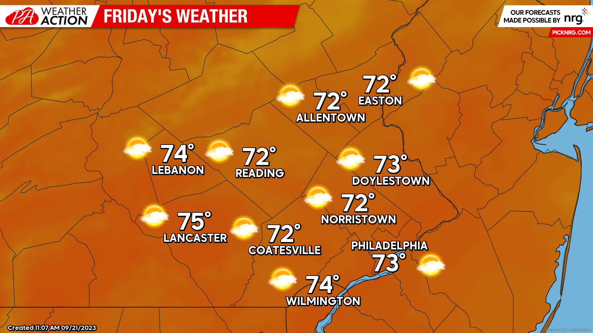
Friday
Friday will be the last day of dry and comfortable weather for several days as Potential Tropical Cyclone 16 (likely soon to be tropical storm Ophelia moves north. Expect mostly sunny skies in the morning to give way to increasing cloud cover throughout the afternoon. Morning lows will start in the Low-Mid 5os, peaking to highs in the Low-Mid 70s by the afternoon.
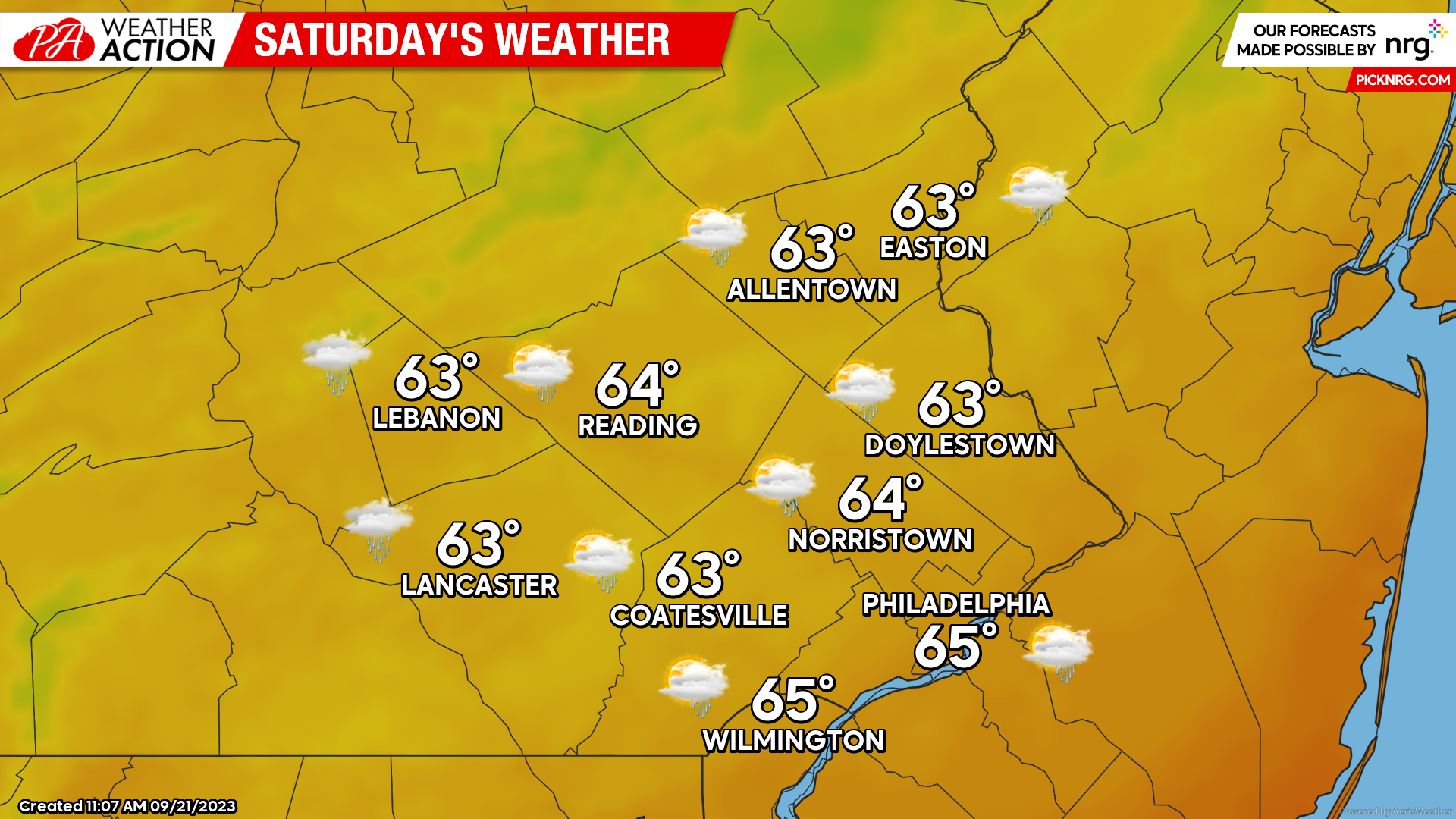
Saturday
Unsettled weather will be the theme throughout Saturday as the coastal low associated with Potential Tropical Cyclone 16 moves north. Rain will overspread the region from south to north during the early morning hours on Saturday. Rain, heavy at times will linger throughout the day on Saturday accompanied by gusty winds at times. Temperatures in the morning will start in the Upper 50s-Low 60s and remain fairly steady throughout the day with highs peaking in the Low-Mid 60s.
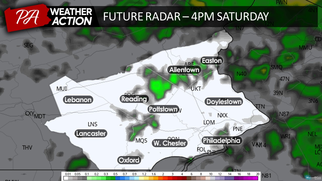
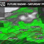
Taking a look at the future radar, we can see that steady rain will begin to overspread the region before sunrise.
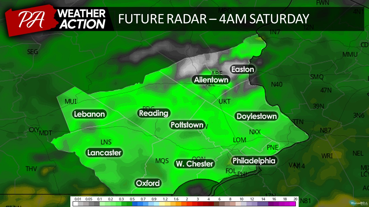
Rain will become heavy at times as we head through the morning on Saturday, localized flash flooding is possible especially in urban/poor-drainage environments. As of now the worst of the weather appears to move through between 8am-12pm.
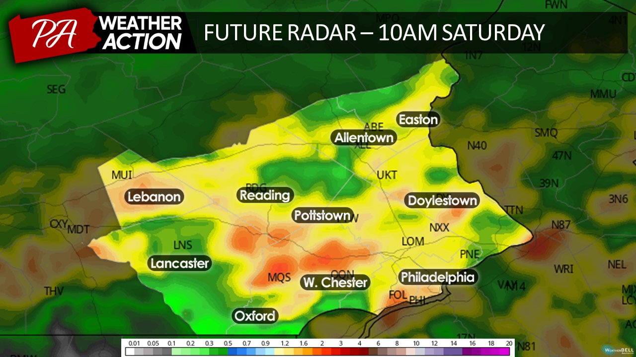
As we head towards the afternoon, drier air will filter in around the center of low pressure which may briefly bring an end to the precipitation. However, scattered showers and downpours will continue to pass through the region into Saturday night.
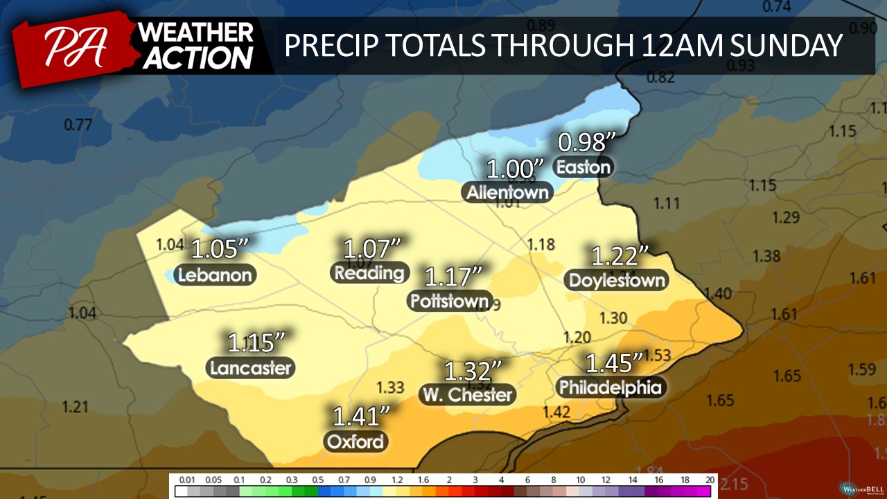
Ultimately, a substantial precipitation event is expected throughout the day on Saturday. A general 1-1.5 inches of rain is expected through the day on Saturday with regions further south and east seeing the highest totals. However, depending on where the heaviest rainfall bands set up, a few areas may receive rainfall over 2″. The Storm Prediction Center has issues a 15% chance of flash flooding across the region.
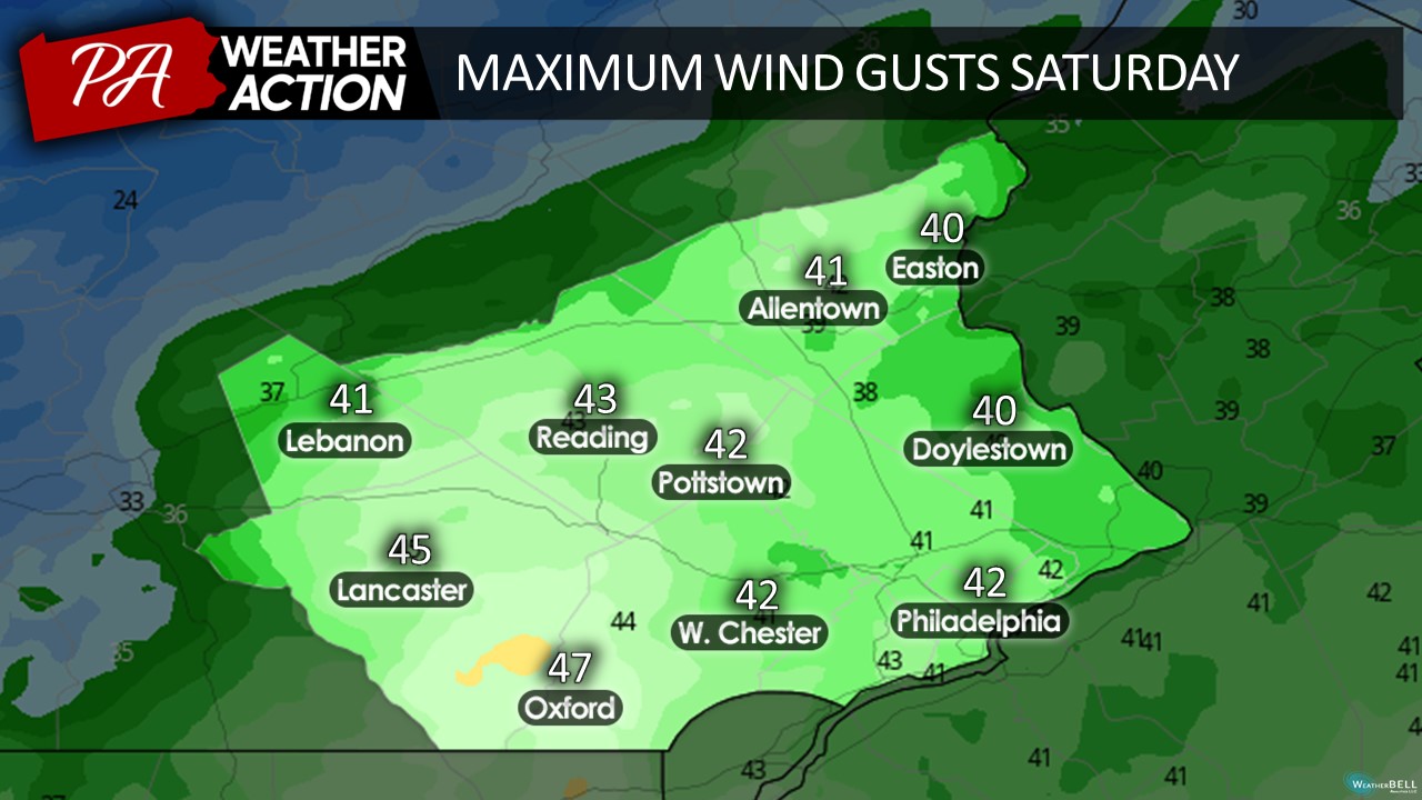
Additionally, gusty winds will accompany the heavy rainfall Saturday with most regions expecting maximum wind gusts of 40-50mph.
Sunday
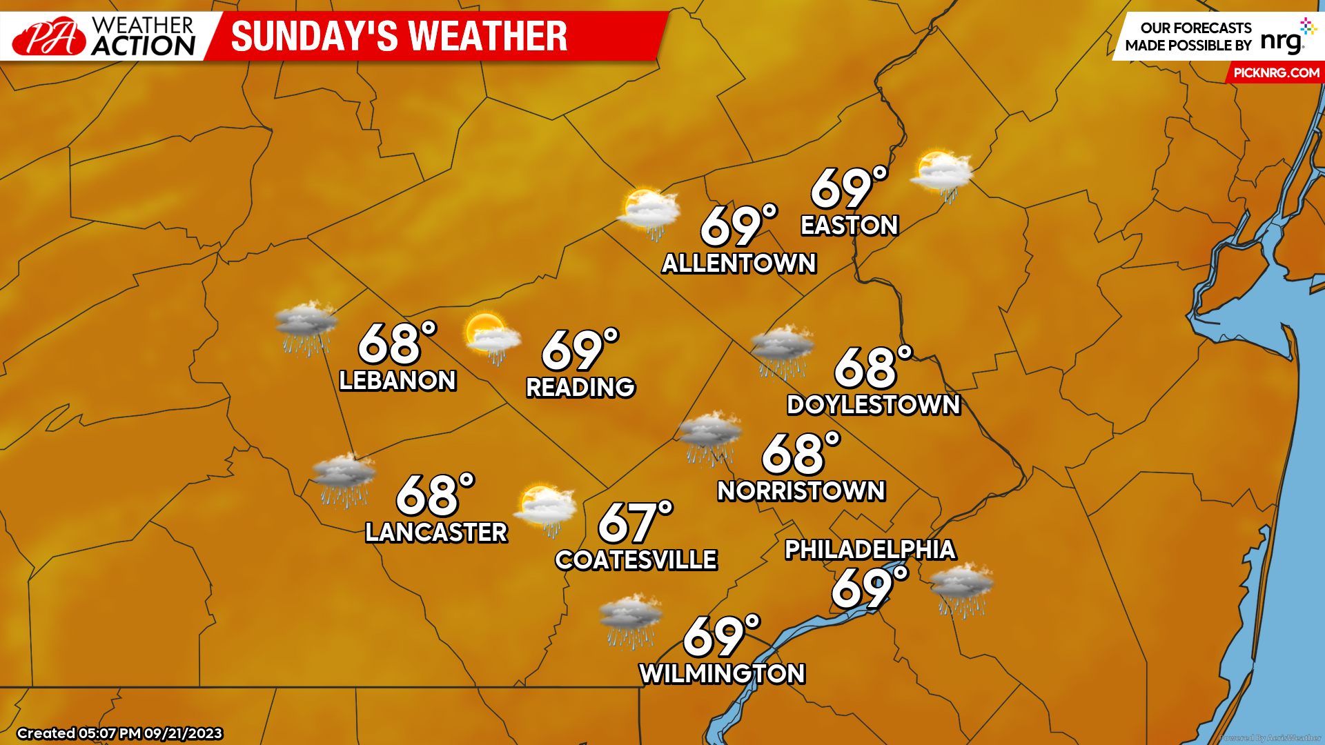
For Sunday, mostly cloudy skies and scattered showers will linger as the coastal low begins to pull away from the region. Areas further north and west may see a few breaks in the clouds by late afternoon. An additional .25-.75 inches of rain is expected. Temperatures Sunday morning will start in the mid-upper 50s with afternoon highs peaking in the upper 60s.
I hope everyone everyone has a great weekend despite the not so great forecast! If you have any questions regarding the upcoming weather feel free to let me know! Make sure to download the PAWeatherAction app for continued updates!
You must be logged in to post a comment.