
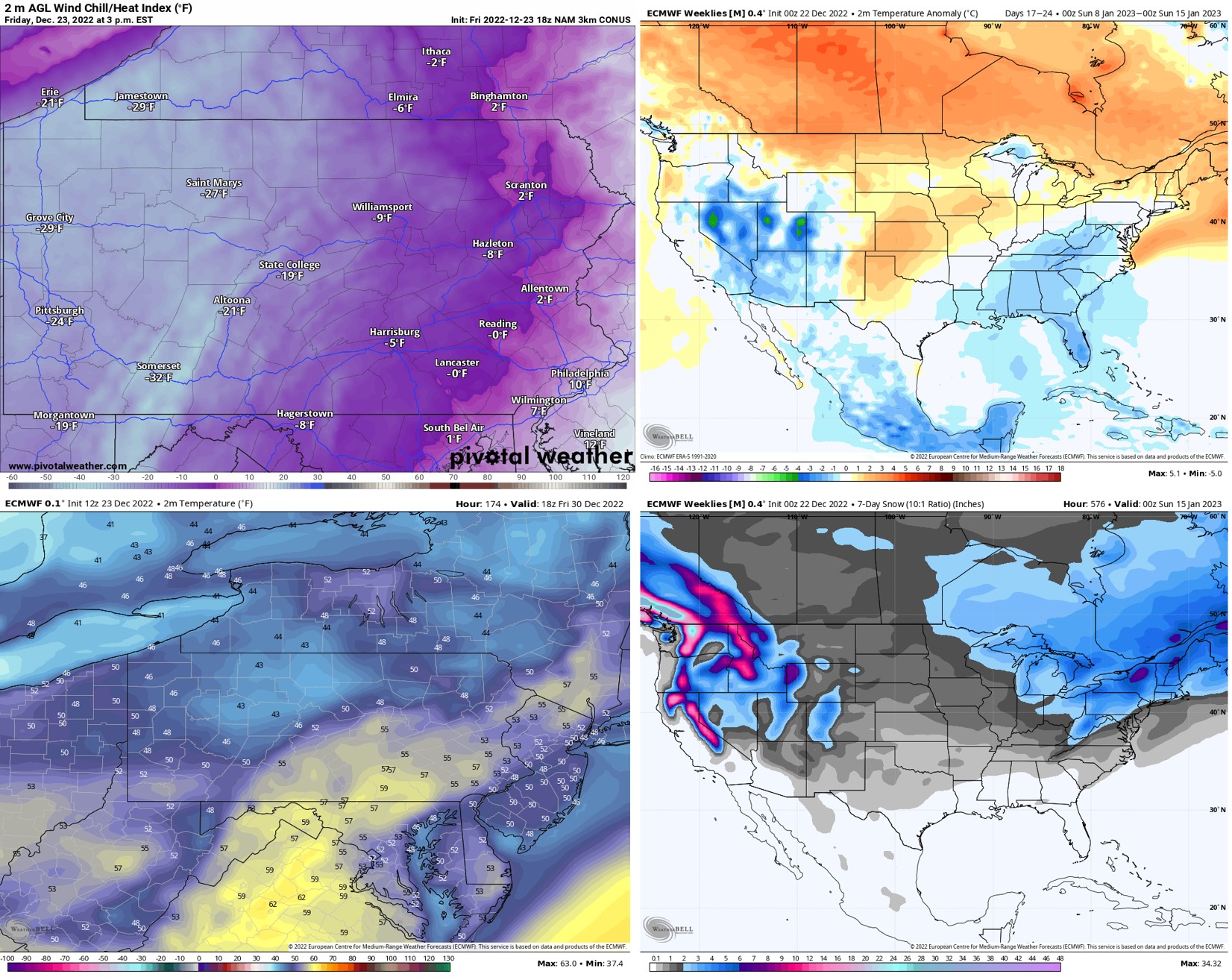
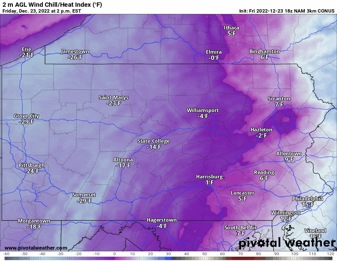
This is the most impressive December Arctic blast I’ve ever seen, although I’m only in my 20s! It just seems like something you’d see once even few years in late January! These wind chills will be awful tonight, and someone in the Laurel Highlands could hit a -40 wind chill. That’s brutal even by Minnesota standards. Wind chills will not be quite as profound on Christmas, but still very cold!
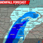
Here’s the wind chill forecast for this Christmas weekend.
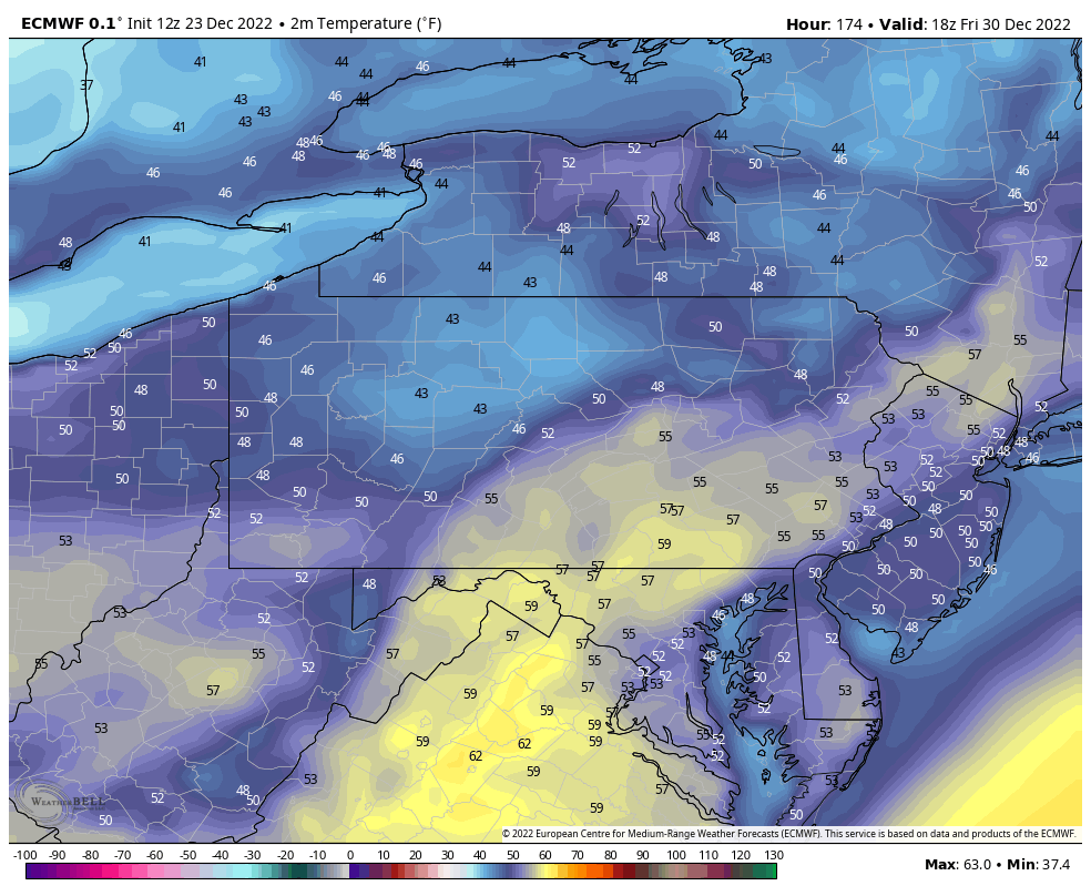
Wind chills will begin to lighten up by Monday, and check this out – by the 30th, some places in Southern PA may be approaching 60 degrees! Might as well plan a trip to the shore right now! In all seriousness, it will be a welcome change.
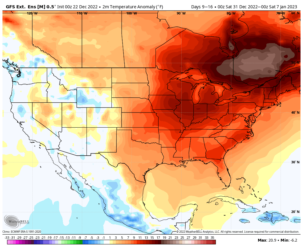
Heading into early January, we will remain warmer than normal. Not quite a torch, as some in the weather community call it, but certainly above average. Here’s the GFS Ensemble Extended model for the first week of January.
One thing people should understand is that pattern changes not last long, especially cold snaps in 2022. They may last a week or 10 days in the heart of winter, but almost never longer than that. I’m watching around January 10-15th for a return to average temperatures, and then the 15th-20th for below average temperatures. Our next widespread snow chance will probably be January 10-20th.
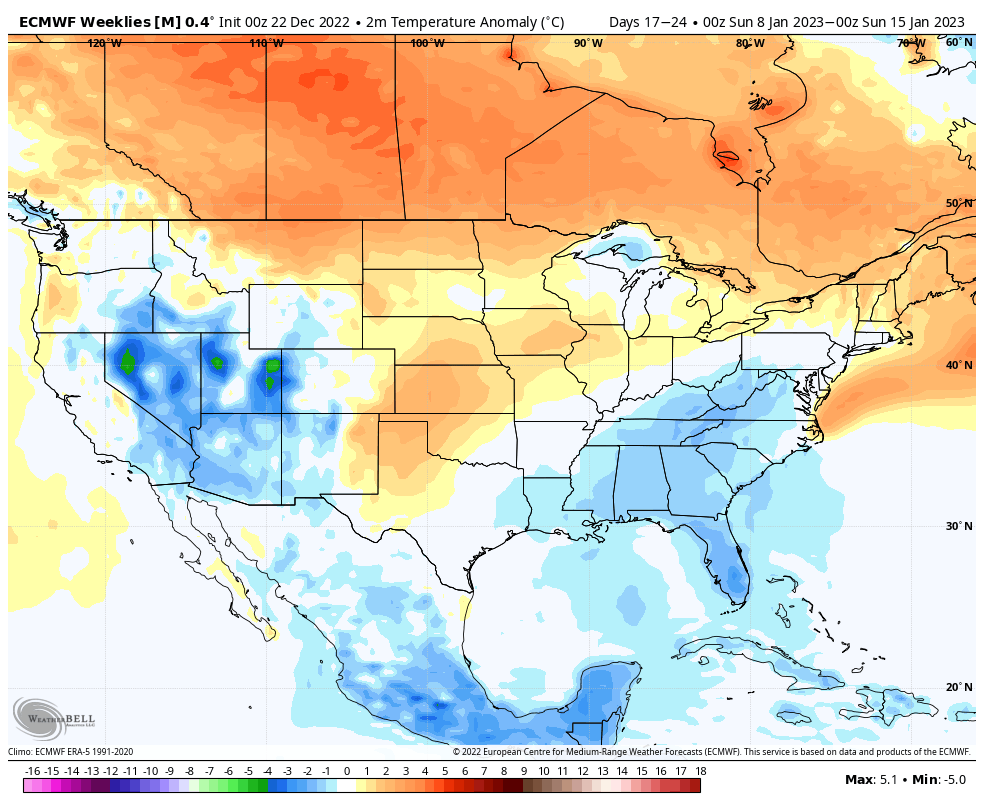
Long range models are actually displaying more of a El Nino-type pattern, with some of the only below average temperatures in the Lower 48 being found in the Southeast and Mid-Atlantic. I actually don’t mind this look, so we’ll see what we can get out of it when the time comes. Here’s the Euro weeklies for the second week of January showing that return to average temperatures.
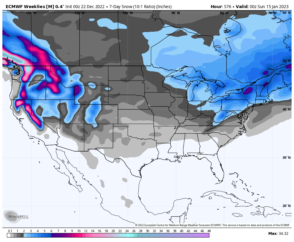
With that type of pattern, we probably won’t have a shortage of precipitation. I’d rather have average temperatures and regular chances for wintry weather than really cold, but multiple weeks of dry conditions with blue skies! As you can see below, the Euro Weeklies is already liking the Northeast during mid-January for some snow. The specific amounts can be disregarded, the story is that is shows snow chances.
Side Note: This article is actually from our app’s Update section, which I personally post on once or twice a day, especially when storms are possible. I will have you very much in the loop on the latest trends for all parts of PA! You also will be able to see all our forecasts and updates ad-free! Tap the image below to head over to our app and from there, the Updates section is in the middle of the menu!
Finally, here’s a bit of the back story behind these temperature swings. The EPO, NAO, and AO are all going positive next week. The MJO is heading into phases 5 and 6, which favor above average temperatures. Right on queue, the PNA, which was the one teleconnection that was limiting us back in mid-December thanks to its negative state, will stay positive which favors below average temperatures, but it’s outnumbered by the rest of the teleconnections.
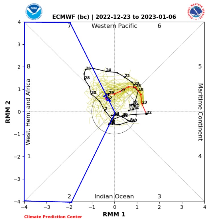
The MJO will be potentially heading into phases 8 or 1 by the second week of January, which would favor a colder pattern for us. Also, the EPO, NAO, and AO will be headed back neutral, with the PNA modeled to stay slightly positive. So this isn’t a bad look, and it’s also not a great look – it’s a decent look. Long range models don’t really know what to do because there’s a lot of mixed signals.
Below is the MJO through January 6th, headed maybe back towards phases 8 and 1. The colder phases for us are outlined in blue. Longer range models then having it going deeper into phases 8 or 1, which are the two most favorable phases for eastern US troughing. But I don’t think a decent pattern for snow-lovers returns until January 10-20th.

You must be logged in to post a comment.