Posted inSevere Weather
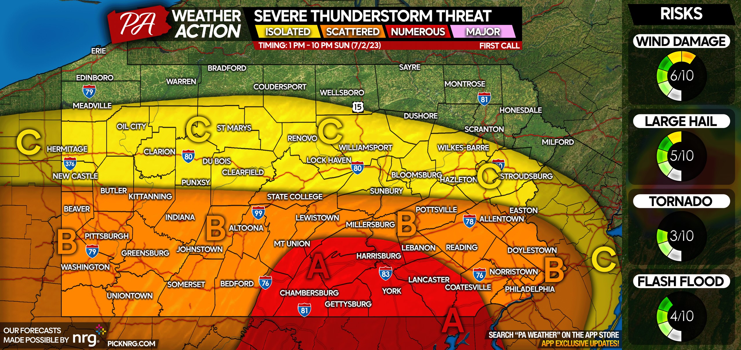
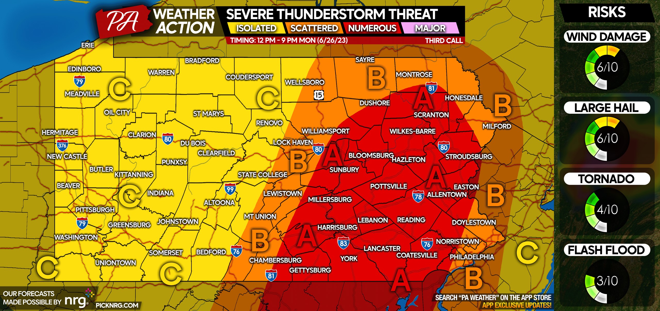
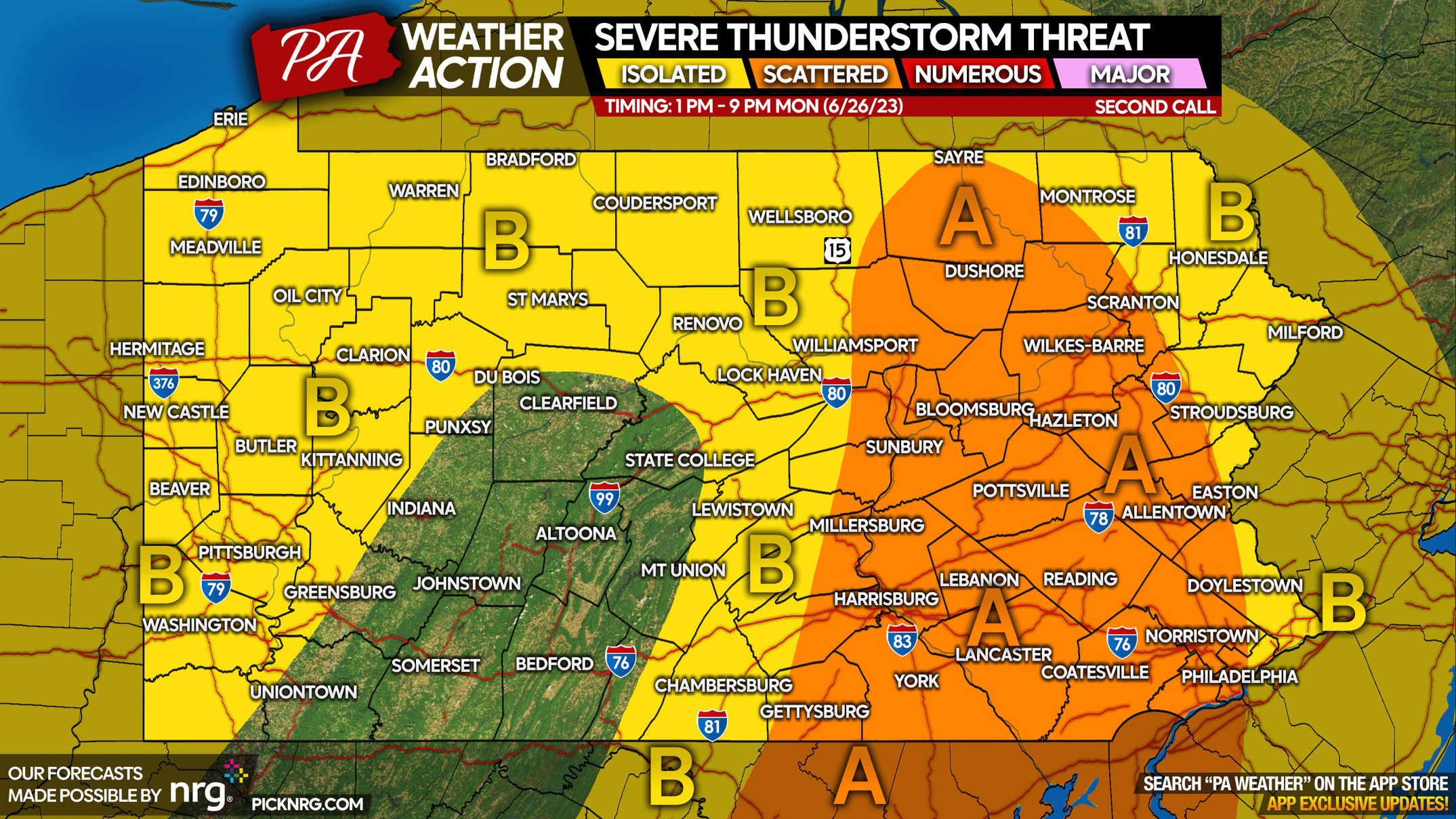
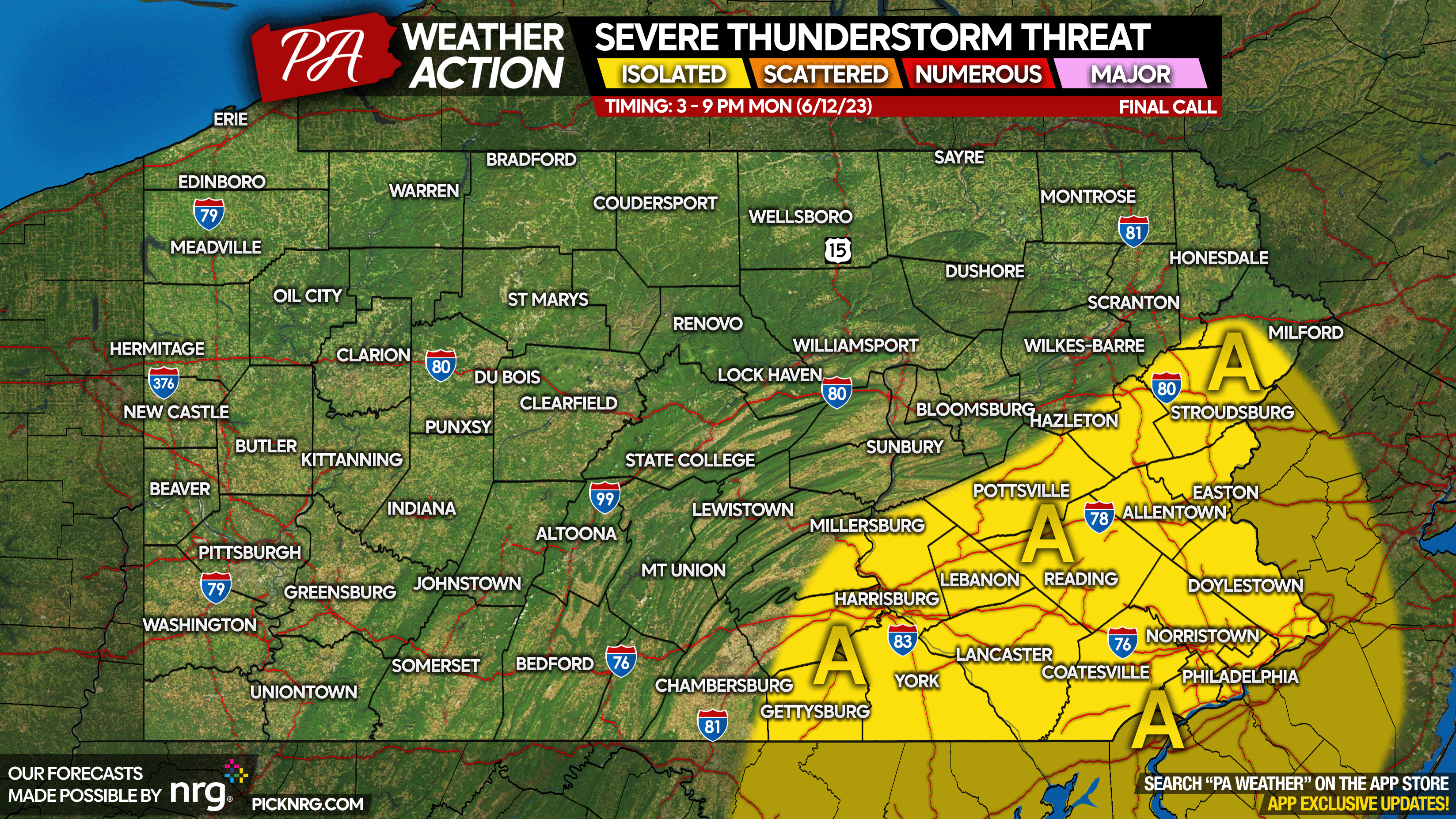
Numerous Severe Thunderstorms Likely Monday in Southern PA; High Winds & Tornadoes Possible
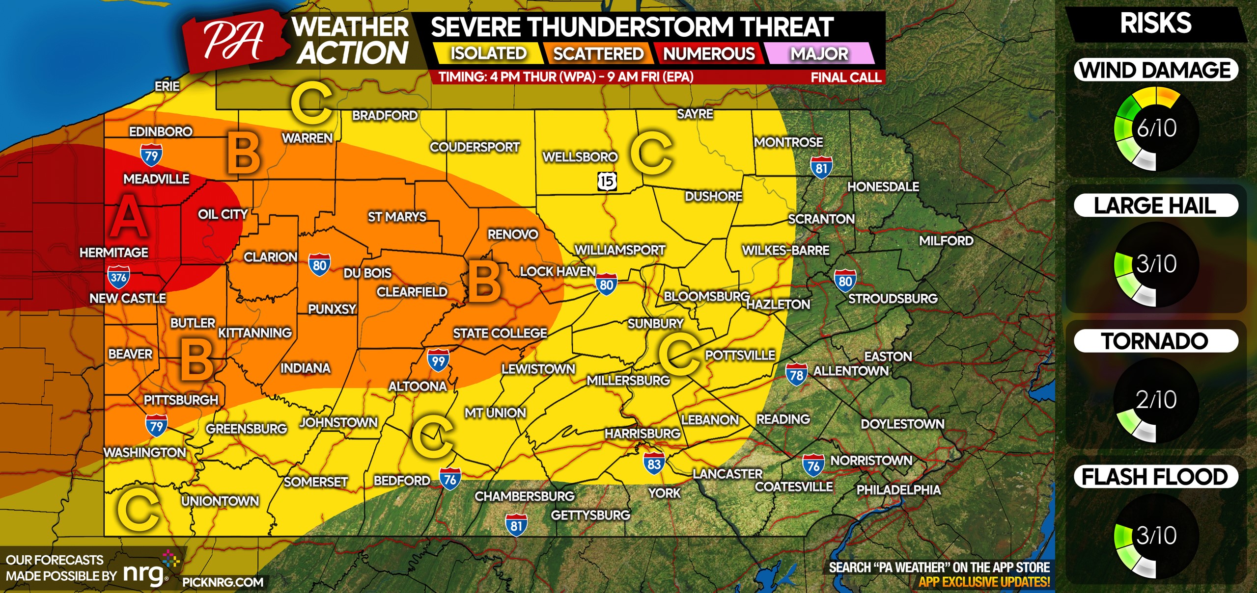
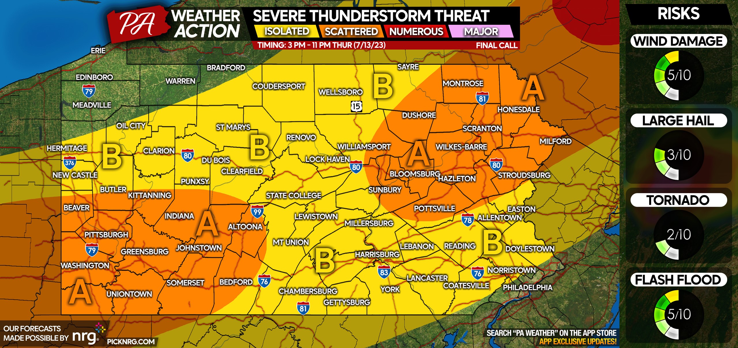
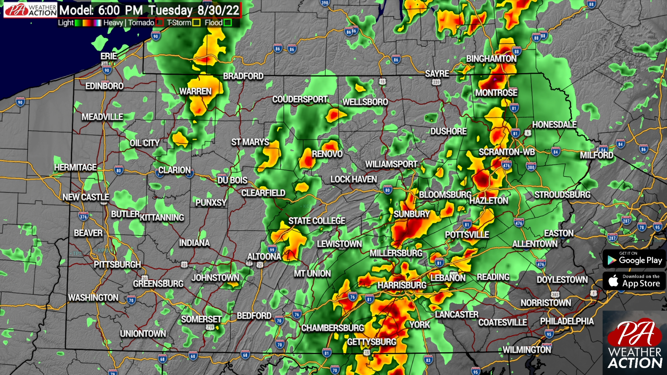
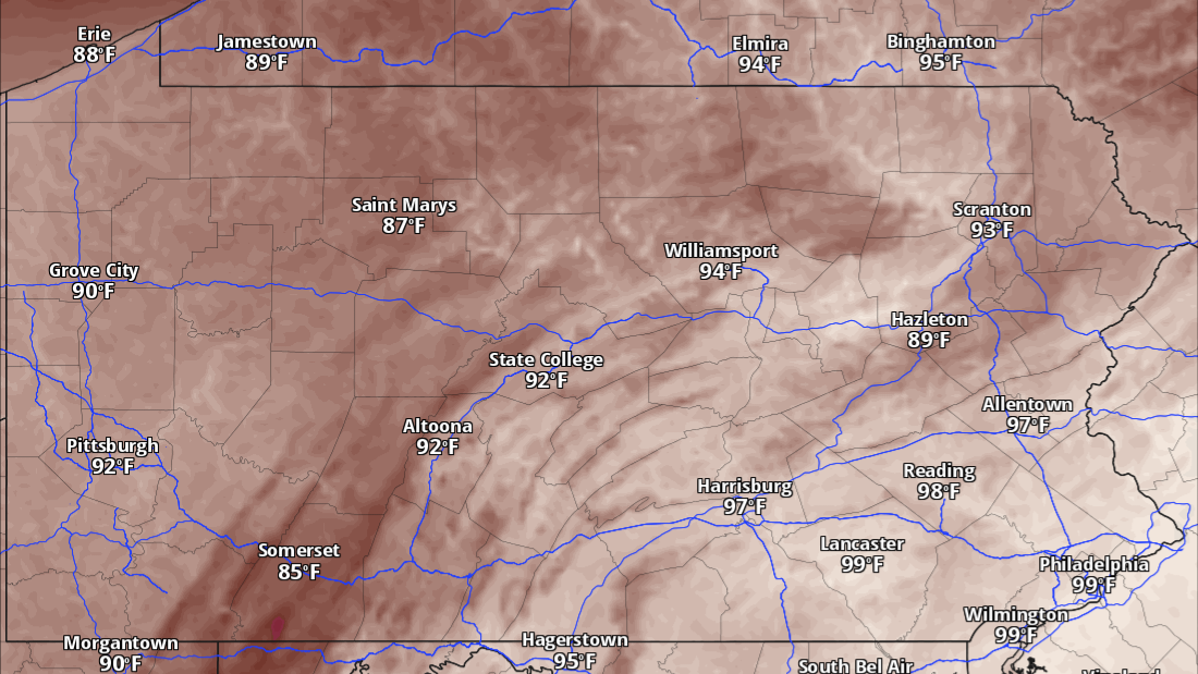
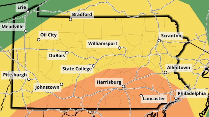
The largest severe weather risk of the year in Pennsylvania is probable Monday as a low pressure system tracks to our northwest over Southern Ontario.…